Brading
The ancient 'Kynges Towne' of Brading is the main town of the civil parish[1] of the same name, which used to cover about a tenth of the Isle of Wight but now includes the town itself and Adgestone, Morton, Nunwell and other outlying areas between Ryde, St Helen's, Bembridge, Sandown and Arreton.
| Brading | |
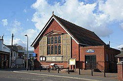
 Brading High Street. |
|
| Population | 2,077 (1991 Census) |
|---|---|
| OS grid reference | SZ607870 |
| Unitary authority | Isle of Wight |
| Ceremonial county | Isle of Wight |
| Region | South East |
| Country | England |
| Sovereign state | United Kingdom |
| Post town | SANDOWN |
| Postcode district | PO36 |
| Dialling code | 01983 |
| Police | Hampshire |
| Fire | Isle of Wight |
| Ambulance | Isle of Wight |
| EU Parliament | South East England |
| UK Parliament | Isle of Wight |
| |
Brading Media
Little Jane's Cottage, Brading, circa 1910 – alluded to by the Rev Legh Richmond
References
| Wikimedia Commons has media related to Lua error in Module:Commons_link at line 62: attempt to index field 'wikibase' (a nil value).. |


