Burlingame, Kansas
Burlingame is a city in Osage County, Kansas, United States. In 2020, 971 people lived there.[4]
 | |
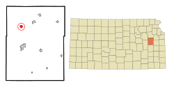
 Location within Osage County and Kansas | |
 | |
| Coordinates: 38°45′3″N 95°50′9″W / 38.75083°N 95.83583°WCoordinates: 38°45′3″N 95°50′9″W / 38.75083°N 95.83583°W[1] | |
| Country | United States |
| State | Kansas |
| County | Osage |
| Incorporated | 1861 |
| Named for | Anson Burlingame |
| Government | |
| • Mayor | Michelle Mullinix [2] |
| Area | |
| • Total | 0.88 sq mi (2.29 km2) |
| • Land | 0.88 sq mi (2.29 km2) |
| • Water | 0.00 sq mi (0.00 km2) |
| Elevation | 1,073 ft (327 m) |
| Population | |
| • Total | 971 |
| • Density | 1,103/sq mi (424.0/km2) |
| Time zone | UTC-6 (CST) |
| • Summer (DST) | UTC-5 (CDT) |
| ZIP code | 66413 |
| FIPS code | 20-09350 [1] |
| GNIS ID | 479434 [1] |
| Website | burlingameks.com |
History
Burlingame was originally created as Council City and was an stop on the Santa Fe Trail. The Council City post office was opened on April 30, 1855.[5] The city and post office name was changed from Council City to Burlingame on January 30, 1858. It was named after Anson Burlingame.[6]
During the American Civil War the townspeople built a stone fort in the middle of the town. Burlingame's Fort was torn down after the war.[7]
Geography
Burlingame[8] is on U.S. Route 56, about 20 miles (32 km) south of Topeka. The United States Census Bureau says that the city has a total area of 0.88 square miles (2.28 km2). All of it is land.[3]
Climate
Burlingame has hot, humid summers and generally mild to cool winters. The Köppen Climate Classification system says that Burlingame has a humid subtropical climate, abbreviated "Cfa" on climate maps.[9]
People
| Historical populations | |||
|---|---|---|---|
| Census | Pop. | %± | |
| 1870 | 655 | ||
| 1880 | 1,370 | 109.2% | |
| 1890 | 1,472 | 7.4% | |
| 1900 | 1,436 | −2.4% | |
| 1910 | 1,422 | −1.0% | |
| 1920 | 1,330 | −6.5% | |
| 1930 | 1,127 | −15.3% | |
| 1940 | 1,019 | −9.6% | |
| 1950 | 1,065 | 4.5% | |
| 1960 | 1,151 | 8.1% | |
| 1970 | 999 | −13.2% | |
| 1980 | 1,239 | 24.0% | |
| 1990 | 1,074 | −13.3% | |
| 2000 | 1,017 | −5.3% | |
| 2010 | 934 | −8.2% | |
| U.S. Decennial Census | |||
Burlingame is part of the Topeka, Kansas Metropolitan Statistical Area.
2020 census
The 2020 census says that there were 971 people, 437 households, and 259 families living in Burlingame. Of the households, 63.6% owned their home and 36.4% rented their home.
The median age was 41.0 years. Of the people, 93.9% were White, 0.4% were Native American, 0.2% were Asian, 0.4% were from some other race, and 5.0% were two or more races. Hispanic or Latino of any race were 3.3% of the people.[4][10]
2010 census
The 2010 census says that there were 934 people, 404 households, and 250 families living in Burlingame.[11]
Famous people
- Maurice Mehl (1887-1966), paleontologist, was born in Burlingame, Kansas
- Victor Murdock (1871-1945), U.S. Representative from Kansas, Progressive Party presidential nominee, 1916.
- Carla Provost (b. 1970), chief of the Border Patrol
- Kenny Starr (b. 1952), Country and Western singer
- Earl Sutherland, Jr. (1915–1974), winner of the 1971 Nobel Prize in physiology and medicine.
- Ron Thornburgh (b. 1962), former Kansas Secretary of State (1994-2010).
- Muriel Window (1892-1965), vaudeville star, Ziegfeld girl, pilot, businesswoman, born in Burlingame
References
- ↑ 1.0 1.1 1.2 1.3 Template:Cite gnis2
- ↑ "Michelle Mullinix, Mayor, City of Burlingame". League of Kansas Municipalities. Retrieved 13 May 2019.
- ↑ 3.0 3.1 "2020 U.S. Gazetteer Files". United States Census Bureau. Retrieved November 30, 2023.
- ↑ 4.0 4.1 4.2 "DP1: PROFILE OF GENERAL POPULATION AND HOUSING CHARACTERISTICS". United States Census Bureau. Retrieved November 30, 2023.
- ↑ "Kansas Post Offices Database", The Kansas Historical Society
- ↑ Blackmar, Frank Wilson (1912). Kansas: A Cyclopedia of State History, Embracing Events, Institutions, Industries, Counties, Cities, Towns, Prominent Persons, Etc. Standard Publishing Company. p. 255. ISBN 9780722249055.
- ↑ "Burlingame Description". MapQuest. 2018 MAPQUEST TOMTOM. Retrieved February 27, 2018.
- ↑ "Mapquest Burlingame". Mapquest Directions. Archived from the original on 2023-08-16. Retrieved 2022-05-30.
- ↑ Climate Summary for Burlingame, Kansas
- ↑ "P16: HOUSEHOLD TYPE". United States Census Bureau. Retrieved December 30, 2023.
- ↑ "American FactFinder". United States Census Bureau. Retrieved 2012-07-06.
Other websites
- City
- Schools
- USD 454, local school district
- Newspaper
- The Osage County Herald-Chronicle Archived 2019-10-22 at the Wayback Machine
- Historical
- Maps
- Burlingame City Map Archived 2020-05-04 at the Wayback Machine, KDOT
