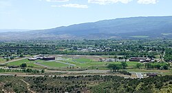
Cedaredge, Colorado
The Town of Cedaredge is a Home Rule Municipality in Delta County, Colorado, United States. The town population was 2,279 at the 2020 United States Census.[7]
| Town of Cedaredge[1] | |
 | |
|
| |
 Location of the Town of Cedaredge in Delta County, Colorado. | |
| Coordinates: 38°53′39″N 107°55′32″W / 38.894137°N 107.925498°WCoordinates: 38°53′39″N 107°55′32″W / 38.894137°N 107.925498°W[2] | |
| Country | |
| State | |
| County | Delta County[1] |
| Incorporated | May 2, 1907[3] |
| Government | |
| • Type | Home rule municipality[1] |
| Area | |
| • Total | 1.961 sq mi (5.078 km2) |
| • Land | 1.961 sq mi (5.078 km2) |
| • Water | 0 sq mi (0.000 km2) |
| Elevation | 6,230 ft (1,899 m) |
| Population | |
| • Total | 2,279 |
| • Density | 1,162/sq mi (449/km2) |
| Time zone | UTC−07:00 (MST) |
| • Summer (DST) | UTC−06:00 (MDT) |
| ZIP Code | 81413[6] |
| FIPS code | 08-12635 |
| GNIS feature ID | 0186245 |
| Website | Town of Cedaredge |
Cedaredge, Colorado Media
References
- ↑ 1.0 1.1 1.2 1.3 "Active Colorado Municipalities". Colorado Department of Local Affairs. Archived from the original on December 12, 2009. Retrieved October 15, 2021.
- ↑ "2014 U.S. Gazetteer Files: Places". United States Census Bureau. July 1, 2014. Retrieved January 5, 2015.
- ↑ "Colorado Municipal Incorporations". State of Colorado, Department of Personnel & Administration, Colorado State Archives. 2004-12-01. Archived from the original on 2010-12-02. Retrieved 2007-09-02.
- ↑ 4.0 4.1 "Decennial Census P.L. 94-171 Redistricting Data". United States Census Bureau, United States Department of Commerce. August 12, 2021. Retrieved September 2, 2021.
- ↑ "US Board on Geographic Names". United States Geological Survey. 2007-10-25. Retrieved 2008-01-31.
- ↑ "ZIP Code Lookup". United States Postal Service. Archived from the original (JavaScript/HTML) on September 3, 2007. Retrieved September 4, 2007.
- ↑ "DP1: PROFILE OF GENERAL POPULATION AND HOUSING CHARACTERISTICS". United States Census Bureau. Retrieved September 13, 2023.

