Dallas County, Texas
Dallas County is a county in the U.S. state of Texas. In 2020, the population was 2,613,539.[1]
| Dallas County, Texas | |
| Map | |
 Location in the state of Texas | |
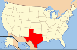
 Texas's location in the U.S. | |
| Statistics | |
| Founded | March 30, 1846 |
|---|---|
| Seat | Dallas |
| Largest City | Dallas |
| Area - Total - Land - Water |
908.54 sq mi (2,353 km²) 873.06 sq mi (2,261 km²) 35.48 sq mi (92 km²), |
| Population - (2020) - Density |
2,613,539 2,994/sq mi (1,156/km²) |
| Time zone | Central: UTC-6/-5 |
| Website: https://www.dallascounty.org | |
| Named for: George M. Dallas | |
| County flag | 
|
The head of the county and biggest city is Dallas. It is the second most populated county in Texas after Harris County. It is the ninth most populated in the whole United States.
Geography
The county has a total area of 909 square miles.
Schools
These school districts are in Dallas County:
- Carrollton-Farmers Branch Independent School District (partly in Denton County)
- Cedar Hill Independent School District
- Coppell Independent School District
- Dallas Independent School District
- DeSoto Independent School District
- Duncanville Independent School District
- Ferris Independent School District (mostly in Ellis County)
- Garland Independent School District
- Grand Prairie Independent School District
- Grapevine-Colleyville Independent School District (mostly in Tarrant County)
- Highland Park Independent School District
- Irving Independent School District
- Lancaster Independent School District
- Mesquite Independent School District
- Richardson Independent School District
- Sunnyvale Independent School District
Places
Cities
Towns
Dallas County, Texas Media
1893 USGS map of Dallas County
- Dallas County Jail 111 W Commerce Street.jpg
Dallas County Jail, 111 West Commerce Street
References
- ↑ "Dallas County, Texas". United States Census Bureau. Retrieved August 5, 2023.


