Dhamtour
Dhamtour or Dhamtor(Pashto: دھمتوڑ, Urdu: دھمتوڑ) is a small rural suburb of Abbottabad Hazara, Khyber Pakhtunkhwa, Pakistan. It is about 6 kilometers from Abbottabad city. It is known as the largest village of Abbottabad area. It is also a Union Council in Abbottabad District in the Khyber Pakhtunkhwa province of Pakistan.[1] The local language is Hindko, which is the main language of Hazara division. The area are has some rich cultural traditions. Dhamtour village is the gate way to many natural beauty places like Murree, Nathia Gali, Dungagali and Harnoi.
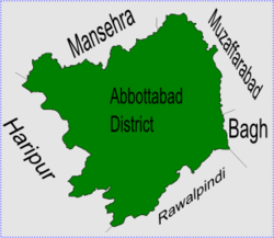
 Dhamtore is in Abbottabad District | |
| Coordinates: 34°7′59″N 73°16′0″E / 34.13306°N 73.26667°ECoordinates: 34°7′59″N 73°16′0″E / 34.13306°N 73.26667°E | |
| Country | Pakistan |
| Province | Khyber Pakhtunkhwa |
| District | Abbottabad |
| Tehsil | Abbottabad |
| Population | |
| • Total | 26,107 |
Location
Dhamtour is at 34°7'60N 73°16'0E at a height of 1110 metres (3645 feet).[2] It is to the west of Abbottabad city, and borders Sheikh-ul-Bandi to the north and Nagri Bala to the south.
History
Dhamtour is an old settlement and there used to be regular cattle and vegetable markets here before British rule.
Tribes
Most of the people in this area are from the Jadoon tribe. Other tribes include Mughals, Gujjars ,Kashmiri, Syeds, and Awans.
Subdivisions
The Union Council of Dhamtour is divided into the following areas: Banda Bazdar, Bandi Shoalian, Dhamtour, Guldhok, Jaswal, Nagaki, and Ukhreela.[1]
Dhamtour Media
References
- ↑ 1.0 1.1 "Dhamtour Union Council - District government Abbottabad". Archived from the original on 2007-12-04. Retrieved 2021-01-18.
- ↑ "Falling Rain Genomics - Location of Dhamtore". Archived from the original on 2007-10-01. Retrieved 2008-03-17.
