Electoral district of Moggill
Moggill is an electoral district of Queensland. It was created in 1986.
| Moggill Queensland—Legislative Assembly | |||||||||||||||
|---|---|---|---|---|---|---|---|---|---|---|---|---|---|---|---|
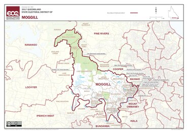 Electoral map of Moggill 2017 | |||||||||||||||
| State | Queensland | ||||||||||||||
| Dates current | 1986–present | ||||||||||||||
| MP | Christian Rowan | ||||||||||||||
| Party | Liberal National | ||||||||||||||
| Namesake | Moggill | ||||||||||||||
| Electors | 34,935 (2020) | ||||||||||||||
| Area | 307 km2 (118.5 sq mi) | ||||||||||||||
| Demographic | Outer-metropolitan | ||||||||||||||
| Coordinates | 27°28′S 152°49′E / 27.467°S 152.817°ECoordinates: 27°28′S 152°49′E / 27.467°S 152.817°E | ||||||||||||||
| |||||||||||||||

Democracy sausages being barbequed at Kenmore State School, which is in Moggill.
Moggill is in Brisbane.
Election results
| 2024 Queensland state election: Moggill[1] | |||||
|---|---|---|---|---|---|
| Party | Candidate | Votes | % | ±% | |
| Liberal National | Christian Rowan | 16,003 | 48.51 | +1.61 | |
| Labor | Eric Richman | 8,655 | 26.24 | -2.16 | |
| Greens | Andrew Kidd | 6,768 | 20.52 | -0.06 | |
| One Nation | Cheryl Wood | 1,562 | 4.73 | +1.83 | |
| Total formal votes | 32,988 | 97.8 | |||
| Informal votes | 727 | 2.2 | |||
| Turnout | 33,715 | 91.20 | |||
| Two-party-preferred result | |||||
| Liberal National | Christian Rowan | 18,350 | 55.63 | +2.03 | |
| Labor | Eric Richman | 14,638 | 44.37 | -2.03 | |
| style="background-color: Template:Liberal National Party of Queensland/meta/color" | | [[Liberal National Party of Queensland|Template:Liberal National Party of Queensland/meta/shortname]] hold | Swing | +2.03 | ||
Electoral District Of Moggill Media

Electoral map of Moggill 2008

References
- ↑ "Moggill - QLD Electorate, Candidates, Results". abc.net.au. 2024-10-27. Retrieved 2024-12-14.