Idukki district
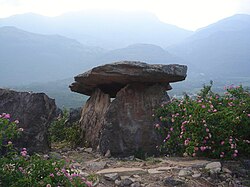
Idukki is one of the 14 districts of Kerala state, India,[1] created on 26 January 1972. At that time, the district headquarters was at Kottayam. In June 1976 it was moved to Painavu. Idukki which lies in the Western Ghats of Kerala. Idukki is the second largest district in area but has the lowest population density. Idukki has a vast forest reserve area; more than a half of the district is covered by forests. The urban areas are densely populated whereas villages are sparsely populated. Idukki is also known as the spice garden of Kerala.
Demographics
According to the 2011 census Idukki district has a population of 1,107,453.[2] This ranks it as 416th among the 640 districts of India. The district has a population density of 254 inhabitants per square kilometre (660/sq mi). Its population growth rate over the decade 2001–2011 was −1.93%. Idukki has a sex ratio of 1006 females for every 1000 males,[2] and a literacy rate of 92.2 per cent.[2] According to the 2011 census, Hindus make up 48. 86% (541,854) of the population, Christians 43.42% (481,507), Muslims 7.41%(82,206). [3]
Tourist area
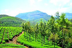
Munnar was the summer resort of the British Government in the south. Munnar has some of the largest tea plantations in the world. This hill station, which is more than 5000 feet above sea level, is a well-known tourist attraction noted for its scenic and picturesque landscapes. Most of the native flora and fauna of Munnar have disappeared due to severe habitat fragmentation resultant from the creation of the plantations.Most of the native flora and fauna of Munnar have disappeared due to severe habitat fragmentation resultant from the creation of the plantations. However, some species continue to survive and thrive in several protected areas nearby, including the new Kurinjimala Sanctuary to the east, the Chinnar Wildlife Sanctuary, Manjampatti Valley and the Amaravati reserve forest of Indira Gandhi Wildlife Sanctuary to the north east, the Eravikulam National Park and Anamudi Shola National Park to the north, the Pampadum Shola National Park to the south and the proposed Palani Hills National Park to the east.
Idukki District Media
- Topography of Kerala.png
Topography and elevation of the High Range region and the Cardamom Hills on Kerala
Kerala during 11th century CE (the region which is marked as Chera). The location of Keezhmalanadu is also marked.
- Map of Thekkumkur in 1790.jpg
Map of Thekkumkur kingdom after the separation of the Poonjar dynasty.
- Travancore 1871.JPG
A map of the British Princely state of Travancore published in 1871
- Thekkady.jpg
A landscape comprising of lake Periyar and mountains at Thekkady.
- Thodupuzha Sree Krishna Swami Temple DSC02584.JPG
- Calvary Mount Church Front Right Idukki Kerala Mar22 A7C 01262.jpg
Calvary Mount Church, Narakakanam
References
- ↑ Idukki District (Variant - V) at GEOnet Names Server, United States National Geospatial-Intelligence Agency
- ↑ 2.0 2.1 2.2 "District Census 2011". Census2011.co.in. 2011. Retrieved 30 September 2011.
- ↑ "Idukki District Population Census 2011, Kerala literacy sex ratio and density". www.census2011.co.in. Retrieved 2016-12-27.
Other websites
| Wikimedia Commons has media related to Lua error in Module:Commons_link at line 62: attempt to index field 'wikibase' (a nil value).. |
- Official Idukki District website Archived 2013-07-24 at the Wayback Machine
- Human Development Index (HDI) and Gender Development Index (GDI) Archived 2008-05-31 at the Wayback Machine
- Idukki district at the Open Directory Project


