Sikkim
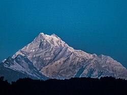
Sikkim (Hindi: सिक्किम) has been a state in India since 1975. It has the smallest number of people and second smallest land size (7,110 square kilometres or 2,750 square miles) of any major divisions in the Republic of India. The third highest mountain in the world, Mt. Kanchenjunga (8,597 metres or 28,205 feet above sea level), is in Sikkim. Its neighbours are Bhutan to the east, Nepal to the west, the Tibet Autonomous Region of P.R.C. to the north and the Indian province of West Bengal to its south. The state capital is Gangtok and other big towns are Gayzing, Pelling, Yuksam and Jorethang. The languages spoken here are Sikkimese, Lepcha, Tibetan, Nepali, Hindi and English. Tourism makes a lot of the money in this small organised state of India, because it is not close to the sea.
|
सिक्किम འབྲས་ལྗོངས། ᰠᰧ ᰧᰀᰕ | |
|---|---|
 | |
 Location of Sikkim in India | |
 Map of Sikkim | |
| Coordinates: 27°33′N 88°30′E / 27.550°N 88.500°ECoordinates: 27°33′N 88°30′E / 27.550°N 88.500°E | |
| Country | |
| Region | North-east India |
| Established | 16 May 1975 |
| Government | |
| • Legislature | Unicameral (seats) |
| Area | |
| • Total | 7,110 km2 (2,750 sq mi) |
| Population (2011) | |
| • Total | 610,577 |
| Time zone | UTC+05:30 (IST) |
| Official languages | Nepali (lingua franca) English Bhutia and Lepcha (since 1977) Limbu (since 1981) Newari, Gurung, Magar, Sherpa, and Tamang (since 1995) Sunwar (since 1996) |
| ^National Anthem of Sikkim [1] | |
Sikkim has been cut off from the outside world for a long time. It was settled by Tibetans in the 16th century. It became a British Protectorate in 1890. Sikkim was transferred to India in 1949 by the British. It was annexed in 1975.
The majority is formed of Bhutias (Tibetan and Bhutnese in origin) and aboriginal Lepchas, who are mainly pastoral nomads. The Sikkimese predominantly practice Hinduism, but the former Chogyal House (“King under the religious laws”) and the official class are Buddhist. Sikkim is known for its Buddhist monasteries. Tibeto-Burmese languages and dialects are commonly spoken. Sikkim is bordered by the Tibet autonomous region of China to north
Physical features
Sikkim is the second smallest state after Goa, but it has many physical features like forests, rivers and mountains around its edges. Most of the mountains are above 6100 metres (20000ft) are near the west of the occupied territory, like Mt Kanchendzonga. Other mountains that are over 6100 meters (20000ft)tall are Kabru (the second tallest), Sinilchu, Pandim, Rothong, Kokthang, Talung, Kanglakhang, Simvo & Jonsang. On the east side the tallest peak is Paunhri, which is about 6700 meters(22000ft) tall. The other mountains that are a little bit shorter than 6100 meters (20000ft) are Masthonangye, Yabukjakchen, Narsing and Lamaonden. Most of the mountains in Sikkim have never been climbed, because the Sikkimese consider them sacred. They feel that when the mountains are climbed, they will not be holy anymore.
Sikkim has many hot springs which are known to be good for health. The most important hot-springs are at Phurchachu (Reshi), Yumthang, Borang, Ralang, Taram-chu and Yumey Samdong. All these hotsprings have a lot of sulfur and are near the river banks. The average temperature of the water in these hot springs is 50 °C.
Lakes
On the way between Gangtok to Nathula, 35 kilometres from Gangtok is Lake Changu (Tsomgo), about 3693 meters (12310 ftp) above Sea level.
Two other lakes nearby are the Bidangcho and the Mememcho. Lake Kechopari is another well-known lake. It is between Gyalshing and Yoksum.
Many of the lakes in Sikkim are on the western border, north of Chiwabhanjang towards the Base Camp. Laxmipokhari, Lampokhari, Majurpokhari, Dud Phokhari, Samiti Lake, and the twin lakes of Ram-Laxman are a few of the lakes in this area.
Gurudogmar, which is the largest lake, is in North Sikkim.
Food
Sikkimese people usually eat rice, green vegetables, potatoes, dal, and sinky, Kenama and Gundruk.
Momo is a very popular Tibetan treat in Sikkim. It is prepared by stuffing meat and vegetable ingredients in flour dough then making them into dumplings. Momos are eaten with soup and chilli sauce. This dish can be found in almost every local restaurant and fast food shop.
Thukpa is a noodle soup with vegetables and beef which is also very popular.
Seal Roti is made by grinding rice and water into a paste, then deep fried. It is normally eaten with potato curry. It is prepared during Dasai and Tihar (local festivals).
Gundruk is the leaves of the mustard oil plant that are dried in the sun, then boiled with ingredients.
Geography
- Area : 7110 km2
- Capital : Gangtok
- Height: 1,780 m (5,840 ft) above sea level
- Population: 6.10 Lakhs (= 610,000)
- Land type: Hilly from 180 m (~600 ft.) to over 8.690 m (28,509 ft) above sea level
- Climate:
- Summer
Max- 21 °C ; Min - 13 °C
- Winter
Max -13 °C ; Min - 0.48 °C Rainfall : 325 cm every year
- Languages spoken: Nepali, Bhutia, Lepcha, Tibetan, English, Hindi
State symbols of Sikkim
| Language: | Sikkimese | |
| Song: | "Music of Sikkim" | |
| Animal: | Red panda | 
|
| Bird: | Ithaginis cruentus | File:BloodPheasantGouldRichter.jpg |
| Tree: | Rhododendron | |
| Flower: | Cymbidium goeringii | 
|
+{{{1}}}−{{{2}}}
Sikkim Media
Guru Rinpoche, patron saint of Sikkim
Sikkim is in lower center of image of the Tibetan Plateau- (NASA Satellite photo).
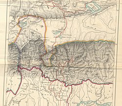
Detailed 1:250k scale, 1955 US Army map of Sikkim showing major river valleys, glaciers, lakes, peaks (height in feet) and Mines. One could see more concentration of glaciers at the north-western part of Sikkim around Kangchenjunga (28,168 feet (8,586 m)).
Images from 2010 Sikkim tour
The red panda is the state animal of Sikkim.
Runway at Pakyong Airport, is the first greenfield airport to be constructed in the Northeast India.
Teesta River is considered the state's key waterway.
Other websites
![]() Media related to Sikkim at Wikimedia Commons
Media related to Sikkim at Wikimedia Commons


