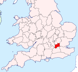
Middlesex
Middlesex is one of the historic counties of England and the second smallest by area.[3] The county once contained the rich and politically independent City of London on its southern boundary.[4] The county was affected by the expansion of London in the 18th and 19th centuries. From 1855 the south east was administered as part of London.[5] When county councils were initially introduced in England in 1889 around 20% of the area of Middlesex, and a third of its population, was transferred to the County of London.[6]
| Middlesex | |
  Ancient and 1889 extent of Middlesex | |
| Geography | |
| Status | Ceremonial county (until 1965) Administrative county (1889–1965) |
| 1801/1881 area | 181,320 acres (734 km2)[1] |
| 1911 area | 148,701 acres (601.8 km2)[2] |
| 1961 area | 148,691 acres (601.7 km2)[2] |
| HQ | see text |
| Chapman code | MDX |
| History | |
| Origin | Middle Saxons |
| Created | In antiquity |
| Succeeded by | 1889: to County of London 1965: Greater London and small parts to Surrey and Hertfordshire |
| Demography | |
|---|---|
| 1801 population - 1801 density |
818,129[1] 4.5/acre |
| 1881 population - 1881 density |
2,920,485[1] 16.1/acre |
| 1911 population - 1911 density |
1,126,465[2] 7.6/acre |
| 1961 population - 1961 density |
2,234,543[2] 15/acre |
| Politics | |
| Governance | Middlesex County Council (1889–1965) |
 Banner of arms of Middlesex County Council | |
| Subdivisions | |
| Type | hundreds (ancient) |
In the interwar years urban London further expanded, with the expansion of public transport,[7] and the setting up of new industries outside inner London.
After a Royal Commission on Local Government in Greater London, Middlesex was absorbed by an enlarged Greater London in 1965. Despite its disappearance as an administrative county, Middlesex is still used as an area name. It was kept as a postal county; it is an optional component of postal addresses.[8] It is still regarded by many as a meaningful area, with its own teams in County cricket, rugby and other sports and pastimes.
Middlesex Media
Map of Middlesex, drawn by Thomas Kitchin, geographer, engraver to the Duke of York, 1769
Map showing boundaries of Middlesex in 1851 and 1911, aside from minor realignments. The small yellow area in the North is Monken Hadley, which was transferred to Hertfordshire; the larger yellow area in the Southeast was transferred to the newly created County of London in 1889.
References
- ↑ 1.0 1.1 1.2 "Table of population, 1801-1901". A History of the County of Middlesex: Volume 22. 1911. Archived from the original on 2011-05-14. Retrieved 2008-02-20.
- ↑ 2.0 2.1 2.2 2.3 Vision of Britain - Middlesex population (area and density). Retrieved on 2008-02-20.
- ↑ Vision of Britain - 1831 Census population. Retrieved on 2008-02-20.
- ↑ The Proceedings of the Old Bailey - Rural Middlesex Archived 2007-10-26 at the Wayback Machine. Retrieved on 20 February 2008.
- ↑ Saint, A., Politics and the people of London: the London County Council (1889-1965), (1989)
- ↑ Barlow, I., Metropolitan Government, (1991)
- ↑ Wolmar, C., The Subterranean Railway, (2004)
- ↑ Royal Mail 2004, p. 9


