Clearwater, Kansas
Clearwater is a city in Sedgwick County, Kansas, United States. In 2010, 2,481 people lived there.[6]
 Location within Sedgwick County and Kansas | |
 | |
| Coordinates: 37°30′20″N 97°30′5″W / 37.50556°N 97.50139°WCoordinates: 37°30′20″N 97°30′5″W / 37.50556°N 97.50139°W | |
| Country | United States |
| State | Kansas |
| County | Sedgwick |
| Founded | 1870 |
| Platted | 1872 |
| Incorporated | 1885 |
| Named for | Water |
| Area | |
| • Total | 1.87 sq mi (4.84 km2) |
| • Land | 1.87 sq mi (4.84 km2) |
| • Water | 0 sq mi (0 km2) |
| Elevation | 1,286 ft (392 m) |
| Population | |
| • Total | 2,481 |
| • Estimate (2016)[3] | 2,519 |
| • Density | 1,327/sq mi (512.6/km2) |
| Time zone | UTC-6 (CST) |
| • Summer (DST) | UTC-5 (CDT) |
| ZIP code | 67026 |
| FIPS code | 20-13925 [4] |
| GNIS ID | 0474315 [5] |
| Website | clearwaterks.org |
History
Clearwater was created in 1870. It was platted as a city in 1872.[7] It was named Clearwater because of the local river named Ninnescah, which translates to "clear water" in English. [8] The first post office in Clearwater was created in 1871. The name of the post office called Clear Water until 1894.[9] The Chisholm Trail went along the east side of the city from 1867 to 1871.[10]
Geography
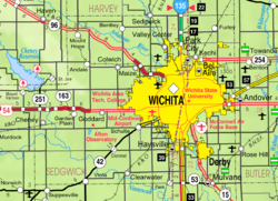
Clearwater is southwest of Wichita, Kansas at 37°30′20″N 97°30′5″W / 37.50556°N 97.50139°W (37.505646, -97.501516).[11] The United States Census Bureau says that the city has a total area of 1.87 square miles (4.84 km2). All of it is land.[1]
People
| Historical populations | |||
|---|---|---|---|
| Census | Pop. | %± | |
| 1890 | 408 | ||
| 1900 | 368 | −9.8% | |
| 1910 | 569 | 54.6% | |
| 1920 | 647 | 13.7% | |
| 1930 | 669 | 3.4% | |
| 1940 | 591 | −11.7% | |
| 1950 | 647 | 9.5% | |
| 1960 | 1,073 | 65.8% | |
| 1970 | 1,435 | 33.7% | |
| 1980 | 1,684 | 17.4% | |
| 1990 | 1,875 | 11.3% | |
| 2000 | 2,178 | 16.2% | |
| 2010 | 2,481 | 13.9% | |
| Est. 2016 | 2,519 | [3] | 15.7% |
| U.S. Decennial Census | |||
2010 census
The 2010 census said that there were 2,481 people, 908 households, and 660 families living in Clearwater.[2]
Education
Clearwater has the Clearwater USD 264 public school district.[12]
Famous people
- Raymond Goertz, roboticist
- Cara Gorges, 2007 Miss Kansas USA
- Pamela Horton, Playboy Playmate of the Month for October 2012.
- Logan Mize, Country Artist
References
- ↑ 1.0 1.1 "US Gazetteer files 2010". United States Census Bureau. Archived from the original on 2012-07-02. Retrieved 2012-07-06.
- ↑ 2.0 2.1 "American FactFinder". United States Census Bureau. Retrieved 2012-07-06.
- ↑ 3.0 3.1 "Population and Housing Unit Estimates". Retrieved June 9, 2017.
- ↑ "American FactFinder". United States Census Bureau. Archived from the original on 2013-09-11. Retrieved 2008-01-31.
- ↑ "US Board on Geographic Names". United States Geological Survey. 2007-10-25. Retrieved 2008-01-31.
- ↑ "2010 City Population and Housing Occupancy Status". U.S. Census Bureau. Archived from the original on July 21, 2011. Retrieved March 6, 2011.
- ↑ Kansas: A Cyclopedia of State History; 1912.
- ↑ Kansas State Historical Society (1916). Biennial Report of the Board of Directors of the Kansas State Historical Society. Kansas State Printing Plant. p. 285.
- ↑ "Kansas Post Offices, 1828-1961". Kansas Historical Society. Archived from the original on October 9, 2013. Retrieved 10 June 2014.
- ↑ Route of the Chisholm cattle trail in Kansas; Kansas Historical Society, 1960s.
- ↑ "US Gazetteer files: 2010, 2000, and 1990". United States Census Bureau. 2011-02-12. Retrieved 2011-04-23.
- ↑ "Clearwater Schools". USD 264. Retrieved 7 January 2017.
Other websites
| Wikimedia Commons has media related to Lua error in Module:Commons_link at line 62: attempt to index field 'wikibase' (a nil value).. |
- City
- Schools
- USD 264, local school district
- USD 264 School District Boundary Map, KDOT
- Historical
- Clearwater Historical Society Archived 2011-02-07 at the Wayback Machine
- Maps
- Clearwater City Map, KDOT