Ehime Prefecture
Ehime Prefecture (愛媛県, Ehime-ken) is a prefecture in the Shikoku region of Japan on the island of Shikoku.[1] The capital city is Matsuyama.[2]
|
愛媛県 | |
|---|---|
| Japanese transcription(s) | |
| • Romaji | Ehime-ken |
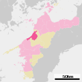
 Location of Ehime in Japan | |
| Coordinates: 33°50′N 132°50′E / 33.833°N 132.833°ECoordinates: 33°50′N 132°50′E / 33.833°N 132.833°E | |
| Country | 22x20px Japan |
| Region | Shikoku |
| Island | Shikoku |
| Capital | Matsuyama |
| Government | |
| • Governor | Tokihiro Nakamura (since December 2010) |
| Area | |
| • Total | 5,676.44 km2 (2,191.69 sq mi) |
| • Rank | 26th |
| Population (November 1, 2010) | |
| • Total | 1,430,086 |
| • Rank | 27th |
| • Density | 251.93361/km2 (652.5050/sq mi) |
| ISO 3166 code | JP-38 |
| Prefectural flower | Satsuma mandarin (Citrus unshiu) |
| Prefectural tree | Pine (Pinus) |
| Prefectural bird | Japanese robin (Erithacus akahige) |
| Prefectural bird | Red sea bream (Pagrus major) |
| Number of districts | 7 |
| Number of municipalities | 20 |
| Website | www.pref.ehime.jp/index-e.htm |
History
Until the Meiji Restoration, Ehime prefecture was known as Iyo Province.[3] The name Ehime comes from the Kojiki. It means "beautiful maiden."
After the Battle of Sekigahara, the Tokugawa shogun gave the area to his allies. Kato Yoshiaki built Matsuyama Castle which became the center of the modern city of Matsuyama.[2]
Geography
Ehime faces the Seto Inland Sea in the southwestern part of Shikoku. The prefecture is bordered by Kagawa Prefecture and Tokushima Prefecture in the east. Kōchi is to the south. The prefecture has a long coastline and it includes many islands.
The Yanase Dam was built in 1953.[4]
Cities
National Parks
National Parks are established in about 7% of the total land area of the prefecture.[5]
Shrines and Temples
Ōyamazumi jinja is the chief Shinto shrine (ichinomiya) in the prefecture. [6]
Ehime Prefecture Media
- Ehime prefecture population pyramid 2020.svg
Ehime prefecture population pyramid in 2020
- Map of Ehime Prefecture Ja.svg
Map of Ehime Prefecture. City Town
- Uwajima City view.JPG
Uwajima city view from Uwajima castle keep
- Ehime Prefectural Government Office 20241205 001.jpg
The Ehime Prefectural Capitol Building
- Flag of Imabari, Ehime.svg
Flag of Imabari, Ehime
- Imabari in Ehime Prefecture Ja.svg
Location of Imabari in Ehime Prefecture
Flag of Matsuyama, Ehime
Related pages
References
- ↑ Nussbaum, Louis-Frédéric. (2002). "Ehime" in Japan Encyclopedia, p. 170; Japan External Trade Organization(JETRO), Ehime Prefecture, Regional Information[dead link]; retrieved 2012-4-6.
- ↑ 2.0 2.1 Nussbaum, "Matsuyama" at p. 621.
- ↑ Nussbaum, "Provinces and prefectures" at p. 780.
- ↑ 4.0 4.1 Berga, L. (2006). Dams and Reservoirs, Societies and Environment in the 21st Century, Vol. 1, p. 41.
- ↑ Japan Ministry of the Environment, "General overview of area figures for Natural Parks by prefecture"; retrieved 2012-3-13.
- ↑ "Nationwide List of Ichinomiya," p. 3 Archived 2013-05-17 at the Wayback Machine; retrieved 2012-2-9.
Other websites
![]() Media related to Ehime prefecture at Wikimedia Commons
Media related to Ehime prefecture at Wikimedia Commons
- http://www.pref.ehime.jp/index-e.htm Archived 2003-02-02 at the Wayback Machine; (in Japanese)


