Huron, Kansas
Huron is a city in Atchison County, Kansas, United States. As of the 2020 census, 74 people lived there.[3]
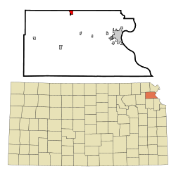
 Location within Atchison County and Kansas | |
 | |
| Coordinates: 39°38′18″N 95°21′04″W / 39.63833°N 95.35111°WCoordinates: 39°38′18″N 95°21′04″W / 39.63833°N 95.35111°W[1] | |
| Country | United States |
| State | Kansas |
| County | Atchison |
| Township | Lancaster |
| Area | |
| • Total | 0.07 sq mi (0.19 km2) |
| • Land | 0.07 sq mi (0.19 km2) |
| • Water | 0.00 sq mi (0.00 km2) |
| Elevation | 1,161 ft (354 m) |
| Population | |
| • Total | 74 |
| • Density | 1,060/sq mi (389/km2) |
| Time zone | UTC−6 (CST) |
| • Summer (DST) | UTC−5 (CDT) |
| ZIP Code | 66041 |
| FIPS code | 20-33575 |
| GNIS ID | 2394458[1] |
History
Huron was platted in 1882. This is when the railroad was extended to that point.[4] The city was named after Col. Anthony Huron, an original owner of the town site.[5]
Geography
Huron is at 39°38′18″N 95°21′4″W / 39.63833°N 95.35111°W (39.638233, -95.351199).
According to the United States Census Bureau says that the city has a total area of 0.07 square miles (0.18 km2). All of it is land.[2]
Demographics
| Historical populations | |||
|---|---|---|---|
| Census | Pop. | %± | |
| 1900 | 200 | ||
| 1910 | 200 | 0.0% | |
| 1920 | 188 | −6.0% | |
| 1930 | 149 | −20.7% | |
| 1940 | 163 | 9.4% | |
| 1950 | 128 | −21.5% | |
| 1960 | 119 | −7.0% | |
| 1970 | 106 | −10.9% | |
| 1980 | 107 | 0.9% | |
| 1990 | 75 | −29.9% | |
| 2000 | 87 | 16.0% | |
| 2010 | 54 | −37.9% | |
| U.S. Decennial Census | |||
2020 census
As of the 2020 census says that there were 74 people, 30 households, and 20 families living in the city. All of the households owned their home.
The median age was 43.5 years. Of the people, 97.3% were White, 1.4% were Black, and 1.4% were from some other race. Hispanic or Latino of any race were 1.4% of the people.[3][6]
2010 census
As of the 2010 census says that there were 54 people, 20 households, and 13 families living in the city.[7]
References
- ↑ 1.0 1.1 1.2 U.S. Geological Survey Geographic Names Information System: Huron, Kansas
- ↑ 2.0 2.1 "2020 U.S. Gazetteer Files". United States Census Bureau. Retrieved November 19, 2023.
- ↑ 3.0 3.1 3.2 "DP1: PROFILE OF GENERAL POPULATION AND HOUSING CHARACTERISTICS". United States Census Bureau. Retrieved November 19, 2023.
- ↑ History of the State of Kansas: Containing a Full Account of Its Growth from an Uninhabited Territory to a Wealthy and Important State. A. T. Andreas. 1883. p. 410.
- ↑ Blackmar, Frank Wilson (1912). Kansas: A Cyclopedia of State History, Embracing Events, Institutions, Industries, Counties, Cities, Towns, Prominent Persons, Etc. Standard Publishing Company. p. 891. ISBN 9780722249055.
- ↑ "P16: HOUSEHOLD TYPE". United States Census Bureau. Retrieved December 31, 2023.
- ↑ "American FactFinder". United States Census Bureau. Retrieved 2012-07-06.
Other websites
- City
- Schools
- USD 377, local school district
- Maps
- Huron City Map Archived 2020-05-04 at the Wayback Machine, KDOT