Irvine, California
Irvine (pronounced /ˈɜrvaɪn/) is a city in Orange County, California, United States. It is a planned city, mostly made by the Irvine Company since the 1960s. The city was formally incorporated on December 28, 1971. The 69.7 square mile (180.5 km2)[source?] city has a population of about 212,793 (as of January 1, 2009).[12] It has united in the past a green belt or greenbelt is a policy and land use designation used in land use planning to retain areas of largely undeveloped area to the north, and has also united the former El Toro Marine Corps Air Station, most of which is planned to be converted into the Orange County Great Park.
|
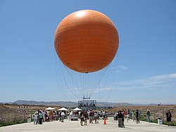
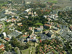
Clockwise from top: Irvine Civic Center, San Joaquin Wildlife Sanctuary, University of California, Irvine, Balloon ride at Orange County Great Park, "Giant Wheel" at Irvine Spectrum Center | |
 Location of Irvine in Orange County, California. | |
| Coordinates: 33°40′10″N 117°49′23″W / 33.66944°N 117.82306°WCoordinates: 33°40′10″N 117°49′23″W / 33.66944°N 117.82306°W[2] | |
| Country | |
| State | |
| County | |
| Incorporated | December 28, 1971[3] |
| Named for | James Irvine |
| Government | |
| • Type | Council-Manager[4] |
| • Mayor | Donald P. Wagner |
| • Mayor Pro Tempore | Lynn Schott |
| • City council members[6] | Melissa Fox Jeffrey Lalloway Christina Shea |
| • City Manager | Sean Joyce[5] |
| Area | |
| • Total | 65.92 sq mi (170.74 km2) |
| • Land | 65.58 sq mi (169.86 km2) |
| • Water | 0.34 sq mi (0.89 km2) 0.52% |
| Elevation | 56 ft (17 m) |
| Population | |
| • Total | 212,375 |
| • Estimate (2018) | 276,176 |
| • Rank | 3rd in Orange County 16th in California 75th in the United States |
| • Density | 4,211.28/sq mi (1,566.75/km2) |
| Time zone | UTC−8 (Pacific) |
| • Summer (DST) | UTC−7 (PDT) |
| ZIP codes[9] | 92602–92604, 92606, 92612, 92614, 92616–92620, 92623, 92650, 92697 |
| FIPS code | 06-36770[10] |
| GNIS feature IDs | 1660804, 2410116 |
| Sphere of influence | 74 miles[11] |
| Website | cityofirvine |
The University of California, the highest level of the state's public higher education system, has a campus in Irvine.
Irvine is part of the Greater Los Angeles Area.
References
| Wikimedia Commons has media related to Lua error in Module:Commons_link at line 62: attempt to index field 'wikibase' (a nil value).. |
- ↑ "Municode Library". library.municode.com.
- ↑ 2.0 2.1 "Irvine". Geographic Names Information System. United States Geological Survey. Retrieved November 6, 2014.
- ↑ "California Cities by Incorporation Date". California Association of Local Agency Formation Commissions. Archived from the original (Word) on November 3, 2014. Retrieved August 25, 2014.
- ↑ "City Charter". City of Irvine. Archived from the original on October 7, 2014. Retrieved October 9, 2014.
- ↑ "City Manager". City of Irvine. Archived from the original on October 26, 2014. Retrieved October 12, 2014.
- ↑ "City Council". City of Irvine. Archived from the original on April 3, 2015. Retrieved December 14, 2016.
- ↑ "2016 U.S. Gazetteer Files". United States Census Bureau. Retrieved July 19, 2017.
- ↑ E-1 Population Estimates for Cities, Counties, and the State — January 1, 2015 and 2016, May 1, 2016
- ↑ "ZIP Code(tm) Lookup". United States Postal Service. Retrieved November 28, 2014.
- ↑ "American FactFinder". United States Census Bureau. Archived from the original on September 11, 2013. Retrieved January 31, 2008.
- ↑ "Demographics Information". City of Irvine. Archived from the original on March 17, 2015. Retrieved January 3, 2017.
- ↑ "E-1 Population Estimates for Cities, Counties and the State with Annual Percent Change — January 1, 2008 and 2009". California Department of Finance. 2009-05. Archived from the original on 2009-05-07. Retrieved 2009-05-02.
{{cite web}}: Check date values in:|date=(help)


