Land
Land can mean some territory, forming part of a country. Dry land is the parts of Earth's surface not covered by the ocean or other permanent body of water. About 29% of the surface of Earth is dry land, while the rest is covered with liquid water. Land can have different types of soil; it may be covered with stones, sand, dirt, etc. Sometimes it is not clear where land ends and a body of water begins.
Amount and types of land
The total area of Earth is about 510 million km2. About 149 million km2, which is 29% of the surface, is land. Large masses of ice called glaciers cover 15 million km2, or 10% of the land area.[1] The biggest continuous landmasses are called continents, and smaller landmasses, surrounded by water, are called islands.
19% of land on Earth (28 million km2), is barren: without plants. This includes deserts, beaches, and rocky areas with no soil. 26% of land (39 million km2) is forests. 8% of land (12 million km2) is shrubland or grassland. 1% of land (1.5 million km2) is cities, towns, and land used for infrastructure. The remaining 34% of land (51 million km2) is used for farming: 7% (11 million km2) for crops (plants) 27% (40 million km2) for livestock (animals).[1]
Formation of land
Even today, some land is being formed and some land is sinking into the ocean. The surface of the earth, which includes both the land and the ocean floor, is made of large pieces of rock called tectonic plates. Continental plates are thicker and lighter, so they stay at the top and make up the land surface. Oceanic plates are thinner and heavier, so they sink down and make up the ocean surface.
Tectonic plates move over time, which is called continental drift. When two continental plates push into each other, they fold upwards to make mountains. When they move apart, they form a rift valley: the East African rift valley is forming now. Islands can be formed by volcanoes: the Hawaiian islands are a good example. Over time, land can wear away through erosion and sink below sea level. This can be seen with the Hawaiian islands, because the newer islands are taller than the older islands.
Land Media
- Coastline as seen from Chimney Rock, Point Reyes National Seashore.jpg
Land between bodies of water at Point Reyes National Seashore, California
- Earth formation.jpg
Artist's conception of Hadean Eon Earth
A topographical map of Japan showing the elevation of the terrain
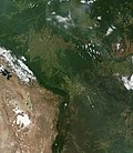
The Andes create a rain shadow, separating the wet Amazon basin from the dry Altiplano.
A simplified diagram of the littoral zone, which includes the coast and nearby waters
The Pirin, a mountain range in Bulgaria
A small, incised alluvial plain from Red Rock Canyon State Park (California)
Land cover as classified by the International Geosphere-Biosphere Programme (IGBP) into 17 classes
Cross section of rankers soil, with plants and protruding roots near the top
Related pages
Other websites
References
- ↑ 1.0 1.1 Ritchie, Hannah; Roser, Max (2013-11-13). "Land Use". Our World in Data.


