List of highest mountains

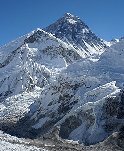
Aerial view of Mount Everest from the south. The peak rises over Lhotse, while Nuptse is the ridge on the left.

This is a list of the highest mountains in the world. There are at least 109 mountains on Earth that are higher than 7,200 metres (23,622 ft) above sea level. Most of these are in central or southern Asia. It is hard to measure how tall a mountain is, so these measurements may not be exact. It is also hard to figure out if two peaks close to each other are part of the same mountain or are two different mountains.

List

Rank Mountain Height (m)[1] Height (ft) Range Coordinates[2] Prominence (m)[3] Parent mountain[4] First ascent Ascents (attempts) bef.2004 [5]
1 Mount Everest/
Sagarmatha /
Chomolungma
8,848[6] 29,029 Mahalangur Himalaya 27°59′17″N 86°55′31″E / 27.98806°N 86.92528°E / 27.98806; 86.92528 8,848 none 1953 145 (121)
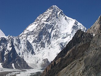
2 K2/
Qogir/
Godwin Austen
8,611 28,251 Baltoro Karakoram 35°52′57″N 76°30′48″E / 35.88250°N 76.51333°E / 35.88250; 76.51333 4,017 Mount Everest [7] 1954 45 (44)
3 Kangchenjunga 8,586 28,169 Kangchenjunga Himalaya 27°42′09″N 88°08′49″E / 27.70250°N 88.14694°E / 27.70250; 88.14694 3,922 Mount Everest 1955 38 (24)
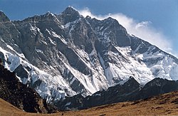
4 Lhotse 8,516 27,940 Mahalangur Himalaya 27°57′42″N 86°55′59″E / 27.96167°N 86.93306°E / 27.96167; 86.93306 610 Mount Everest 1956 26 (26)
5 Makalu 8,485 27,838 Mahalangur Himalaya 27°53′21″N 87°05′19″E / 27.88917°N 87.08861°E / 27.88917; 87.08861 2,386 Mount Everest (Lhotse) 1955 45 (52)
6 Cho Oyu 8,188 26,864 Mahalangur Himalaya 28°05′39″N 86°39′39″E / 28.09417°N 86.66083°E / 28.09417; 86.66083 2,340 Mount Everest 1954 79 (28)
7 Dhaulagiri I 8,167 26,795 Dhaulagiri Himalaya 28°41′45″N 83°29′36″E / 28.69583°N 83.49333°E / 28.69583; 83.49333 3,357 K2 1960 51 (39)
8 Manaslu 8,163 26,781 Manaslu Himalaya 28°32′58″N 84°33′39″E / 28.54944°N 84.56083°E / 28.54944; 84.56083 3,092 Cho Oyu 1956 49 (45)
9 Nanga Parbat 8,126 26,660 Nanga Parbat Himalaya 35°14′18″N 74°35′22″E / 35.23833°N 74.58944°E / 35.23833; 74.58944 4,608 Dhaulagiri 1953 52 (67)
10 Annapurna I 8,091 26,545 Annapurna Himalaya 28°35′43″N 83°49′11″E / 28.59528°N 83.81972°E / 28.59528; 83.81972 2,984 Cho Oyu 1950 36 (47)
11 Gasherbrum I 8,080 26,509 Baltoro Karakoram 35°43′27″N 76°41′44″E / 35.72417°N 76.69556°E / 35.72417; 76.69556 2,155 K2 1958 31 (16)
12 Broad Peak 8,051 26,414 Baltoro Karakoram 35°48′38″N 76°34′05″E / 35.81056°N 76.56806°E / 35.81056; 76.56806 1,701 Gasherbrum I 1957 39 (19)
13 Gasherbrum II 8,034 26,362 Baltoro Karakoram 35°45′27″N 76°39′11″E / 35.75750°N 76.65306°E / 35.75750; 76.65306 1,523 Gasherbrum I 1956 54 (12)
14 Shishapangma 8,027 26,335 Jugal Himalaya 28°21′12″N 85°46′43″E / 28.35333°N 85.77861°E / 28.35333; 85.77861 2,897 Cho Oyu 1964 43 (19)
15 Gyachung Kang 7,952 26,089 Mahalangur Himalaya 28°05′52″N 86°44′47″E / 28.09778°N 86.74639°E / 28.09778; 86.74639 700 Cho Oyu 1964 5 (3)
Gasherbrum III 7,946 26,070 Baltoro Karakoram 35°45′34″N 76°38′31″E / 35.75944°N 76.64194°E / 35.75944; 76.64194 355 Gasherbrum II 1975 2 (2)
16 Annapurna II 7,937 26,040 Annapurna Himalaya 28°32′03″N 84°07′20″E / 28.53417°N 84.12222°E / 28.53417; 84.12222 2,437 Annapurna I 1960 6 (19)
17 Gasherbrum IV 7,932 26,024 Baltoro Karakoram 35°45′33″N 76°36′57″E / 35.75917°N 76.61583°E / 35.75917; 76.61583 715 Gasherbrum III 1958 4 (11)
18 Himalchuli 7,893 25,896 Manaslu Himalaya 28°26′07″N 84°38′24″E / 28.43528°N 84.64000°E / 28.43528; 84.64000 1,633 Manaslu 1960 6 (12)
19 Distaghil Sar 7,884 25,866 Hispar Karakoram 36°19′33″N 75°11′18″E / 36.32583°N 75.18833°E / 36.32583; 75.18833 2,525 K2 1960 3 (5)
20 Ngadi Chuli 7,871 25,823 Manaslu Himalaya 28°30′12″N 84°34′03″E / 28.50333°N 84.56750°E / 28.50333; 84.56750 1,020 Manaslu 1970 2 (6)
Nuptse 7,864 25,801 Mahalangur Himalaya 27°58′02″N 86°53′10″E / 27.96722°N 86.88611°E / 27.96722; 86.88611 319 Lhotse 1961 5 (12)
21 Khunyang Chhish 7,823 25,666 Hispar Karakoram 36°12′19″N 75°12′28″E / 36.20528°N 75.20778°E / 36.20528; 75.20778 1,765 Distaghil Sar 1971 2 (6)
22 Masherbrum 7,821 25,659 Masherbrum Karakoram 35°38′28″N 76°18′21″E / 35.64111°N 76.30583°E / 35.64111; 76.30583 2,457 Gasherbrum I 1960 4 (9)
23 Nanda Devi 7,816 25,643 Garhwal Himalaya 30°22′36″N 79°58′15″E / 30.37667°N 79.97083°E / 30.37667; 79.97083 3,139 Dhaulagiri 1936 14 (12)
24 Chomo Lonzo 7,804 25,604 Mahalangur Himalaya 27°55′48″N 87°06′29″E / 27.93000°N 87.10806°E / 27.93000; 87.10806 590 Makalu 1954 3 (1)
25 Batura Sar 7,795 25,574 Batura Karakoram 36°30′36″N 74°31′27″E / 36.51000°N 74.52417°E / 36.51000; 74.52417 3,118 Distaghil Sar 1976 4 (6)
26 Kanjut Sar 7,790 25,558 Hispar Karakoram 36°12′18″N 75°25′04″E / 36.20500°N 75.41778°E / 36.20500; 75.41778 1,690 Khunyang Chhish 1959 2 (1)
27 Rakaposhi 7,788 25,551 Rakaposhi-Haramosh Karakoram 36°08′33″N 74°29′21″E / 36.14250°N 74.48917°E / 36.14250; 74.48917 2,818 Khunyang Chhish 1958 8 (13)
28 Namcha Barwa 7,782 25,531 Assam Himalaya 29°37′50″N 95°03′19″E / 29.63056°N 95.05528°E / 29.63056; 95.05528 4,106 Kangchenjunga 1992 1 (2)
29 Kamet 7,756 25,446 Garhwal Himalaya 30°55′12″N 79°35′30″E / 30.92000°N 79.59167°E / 30.92000; 79.59167 2,825 Nanda Devi 1931 23 (14)
30 Dhaulagiri II 7,751 25,430 Dhaulagiri Himalaya 28°45′46″N 83°23′14″E / 28.76278°N 83.38722°E / 28.76278; 83.38722 2,396 Dhaulagiri 1971 4 (11)
31 Saltoro Kangri 7,742 25,400 Saltoro Karakoram 35°23′57″N 76°50′51″E / 35.39917°N 76.84750°E / 35.39917; 76.84750 2,160 Gasherbrum I 1962 2 (1)
32 Jannu 7,711 25,299 Kangchenjunga Himalaya 27°40′54″N 88°02′36″E / 27.68167°N 88.04333°E / 27.68167; 88.04333 1,036 Kangchenjunga 1962 17 (12)
33 Tirich Mir 7,708 25,289 Hindu Kush 36°15′19″N 71°50′30″E / 36.25528°N 71.84167°E / 36.25528; 71.84167 3,910 Batura Sar 1950 20 (11)
Molamenqing 7,703 25,272 Langtang Himalaya 28°21′17″N 85°48′39″E / 28.35472°N 85.81083°E / 28.35472; 85.81083 430 Shishapangma 1981 1 (0)
34 Gurla Mandhata 7,694 25,243 Nalakankar Himalaya 30°26′17″N 81°17′53″E / 30.43806°N 81.29806°E / 30.43806; 81.29806 2,788 Dhaulagiri 1985 6 (4)
35 Saser Kangri I 7,672 25,171 Saser Karakoram 34°52′00″N 77°45′09″E / 34.86667°N 77.75250°E / 34.86667; 77.75250 2,304 Gasherbrum I 1973 6 (4)
36 Chogolisa 7,665 25,148 Masherbrum Karakoram 35°36′42″N 76°34′18″E / 35.61167°N 76.57167°E / 35.61167; 76.57167 1,624 Masherbrum 1975 4 (2)
Dhaulagiri IV 7,661 25,135 Dhaulagiri Himalaya 28°44′09″N 83°18′55″E / 28.73583°N 83.31528°E / 28.73583; 83.31528 469 Dhaulagiri II 1975 2 (10)
37 Kongur Tagh 7,649 25,095 Kongur Shan Kunlun 38°35′36″N 75°18′48″E / 38.59333°N 75.31333°E / 38.59333; 75.31333 3,585 Distaghil Sar 1981 2 (4)
Dhaulagiri V 7,618 24,993 Dhaulagiri Himalaya 28°44′02″N 83°21′41″E / 28.73389°N 83.36139°E / 28.73389; 83.36139 340 Dhaulagiri IV 1975 2 (3)
38 Shispare 7,611 24,970 Batura Karakoram 36°26′26″N 74°40′51″E / 36.44056°N 74.68083°E / 36.44056; 74.68083 1,240 Batura Sar 1974 3 (1)
39 Trivor 7,577 24,859 Hispar Karakoram 36°17′15″N 75°05′10″E / 36.28750°N 75.08611°E / 36.28750; 75.08611 980 Distaghil Sar 1960 2 (5)
40 Gangkhar Puensum 7,570 24,836 Kula Kangri Himalaya 28°02′48″N 90°27′21″E / 28.04667°N 90.45583°E / 28.04667; 90.45583 2,995 Kangchenjunga unclimbed 0 (3)
41 Gongga Shan/
Minya Konka
7,556 24,790 Daxue Shan 29°35′43″N 101°52′47″E / 29.59528°N 101.87972°E / 29.59528; 101.87972 3,642 Mount Everest 1932 6 (7)
42 Annapurna III 7,555 24,787 Annapurna Himalaya 28°35′05″N 83°59′28″E / 28.58472°N 83.99111°E / 28.58472; 83.99111 703 Annapurna I 1961 10 (17)
43 Muztagh Ata 7,546 24,757 Muztagata Kunlun 38°16′42″N 75°06′57″E / 38.27833°N 75.11583°E / 38.27833; 75.11583 2,735 Kongur Tagh 1956 many
44 Skyang Kangri 7,545 24,754 Baltoro Karakoram 35°55′35″N 76°34′03″E / 35.92639°N 76.56750°E / 35.92639; 76.56750 1,085 K2 1976 1 (2)
45 Changtse 7,543 24,747 Mahalangur Himalaya 28°01′29″N 86°54′31″E / 28.02472°N 86.90861°E / 28.02472; 86.90861 520 Mount Everest 1982 9 (9)
46 Kula Kangri 7,538 24,731 Kula Kangri Himalaya 28°13′34″N 90°36′54″E / 28.22611°N 90.61500°E / 28.22611; 90.61500 1,650 Gangkhar Puensum 1986 3 (2)
47 Kongur Tiube 7,530 24,705 Kongur Shan Kunlun 38°36′59″N 75°11′55″E / 38.61639°N 75.19861°E / 38.61639; 75.19861 840 Kongur Tagh 1956 2 (3)
48 Mamostong Kangri 7,516 24,659 Rimo Karakoram 35°08′27″N 77°34′39″E / 35.14083°N 77.57750°E / 35.14083; 77.57750 1,803 Gasherbrum I 1984 5 (0)
49 Saser Kangri II E 7,513 24,649 Saser Karakoram 34°48′15″N 77°48′18″E / 34.80417°N 77.80500°E / 34.80417; 77.80500 1,450 Saser Kangri I 2011 0 (0)
50 Ismoil Somoni Peak 7,495 24,590 Pamir (Akademiya Nauk Range) 38°56′32″N 72°00′57″E / 38.94222°N 72.01583°E / 38.94222; 72.01583 3,402 Muztagh Ata 1933

Gallery

List Of Highest Mountains Media

Footnotes

  1. For Nepal, the heights indicated on the Nepal Topographic Maps are followed. For China and the Baltoro Karakoram, the heights are those of "The Maps of Snow Mountains in China". For the Hispar Karakoram the heights on a Russian 1:100,000 topo map [1] Archived 2008-04-27 at the Wayback Machine seem to be more accurate than the customarily quoted heights probably based on US army maps from the 50s [2] Archived 2013-07-25 at the Wayback Machine. Elsewhere, unless otherwise indicated, heights are those in Jill Neate's "High Asia".
  2. The region is beautifully covered by Terraserver.com and Google Maps Satellite imagery. Coordinates were established by comparing topographical maps with these satellite images.
  3. The prominence data were extracted from a combination of maps and computer aided analysis of NASA's 3" SRTM data. Prominences over 1,450 m were copied from this website.
  4. Here defined as the first higher mountain beyond the key saddle with at least 500 m prominence itself.
  5. The number of ascents and failed attempts up to 2004 is extracted from the Alpine Club Himalayan index. These are the number of expeditions (not individuals) that announced their ascent or attempt in a journal. They are probably quite accurate for the rarely climbed peaks (though omissions were noted), but greatly underestimate the number of ascending parties on the easier and/or more popular mountains, like most eight-thousanders. For instance, Mt Everest has been scaled 2,251 times by individuals up to 2004 [3].
  6. Given the large differences between multiple "final" measurements of Mt Everest, the traditional 8,848 m is listed. For more information, see Mount Everest#Measurement.
  7. Everest IS parent to K2 by the definition of topographic prominence. See also, the discussion page.

Related pages

Other websites