Mazatlán
Mazatlán (Spanish pronunciation: [ma sat ˈlan]) is a city in the Mexican state of Sinaloa; the surrounding municipio (municipality) for which the city serves as the municipal capital is also called Mazatlán. It is located at 23°13′N 106°25′W / 23.217°N 106.417°W on the Pacific coast, just across from the southernmost tip of the Baja California peninsula.
|
Port of Mazatlan | |
|---|---|
 | |
 Coat of arms | |
|
| |
 | |
| Coordinates: Coordinates: 23°13′12″N 106°25′12″W / 23.22000°N 106.42000°W | |
| Country | |
| State | Sinaloa |
| Municipality | Mazatlán |
| Settled | May 14, 1531 |
| Government | |
| • Mayor | Jorge Abel López Sánchez |
| Area | |
| • Municipality | 3,068.5 km2 (1,184.75 sq mi) |
| Population (2005) | |
| • Total | 352,471 |
| • Demonym | Mazatleco(a) |
| Time zone | UTC-7 (MST) |
| Postal code | 82000- |
| Website | http://www.mazatlan.gob.mx |
Mazatlán is a Nahuatl word meaning "place of the deer." The city was started in 1531. By the mid-1800s a large group of immigrants had arrived from Germany. These new citizens made Mazatlán into a successful commercial seaport, importing equipment for the nearby gold and silver mines. It served as the capital of Sinaloa from 1859 to 1873. They also influenced the music, banda, which is an form of Bavarian folk music, and also started the Pacifico Brewery on March 14, 1900.
Mazatlán, with a population of 352,471 (city) and 403,888 (municipality) as of the 2005 census, is the second-largest city in the state (after Culiacán) and Mexico's largest commercial port. It is also a popular tourist destination, with its beaches lined with resort hotels. A car ferry across the Gulf of California from Mazatlán to La Paz, Baja California Sur exists. The municipality has a land area of 3,068.48 km² (1,184.75 sq mi) and includes smaller communities such as Villa Unión, La Noria, El Quelite, El Habal and many other small villages.
Mazatlán is served by Gral. Rafael Buelna International Airport.
Sister towns
Cityscape
Communities and neighborhoods
| Communities of Mazatlan |
|---|
|
Beaches and parks
Viejo Mazatlan & Centro area:
- Olas Altas
- Playa Norte
- Los Pinitos
Zona Dorada (Golden Zone):
- Gaviotas
- Sabalos
- Playa Camaron
Nuevo Mazatlan area:
- Cerritos
- Playa Bruja
- El Delfin
- Marmol
Isla de la Piedra:
Gallery

Valentinos from Playa Mazatlan

Parasailing near the Hotel Playa Mazatlan

Main entrance to the Hotel Playa Mazatlan

Church El Centro Mazatlan

Cliff diver, Mazatlan Mexico.


| Weather chart for Mazatlán | |||||||||||||||||||||||||||||||||||||||||||||||
|---|---|---|---|---|---|---|---|---|---|---|---|---|---|---|---|---|---|---|---|---|---|---|---|---|---|---|---|---|---|---|---|---|---|---|---|---|---|---|---|---|---|---|---|---|---|---|---|
| J | F | M | A | M | J | J | A | S | O | N | D | ||||||||||||||||||||||||||||||||||||
11
26
11
|
14
25
11
|
6
26
11
|
2
27
13
|
5
29
17
|
29
31
22
|
161
31
23
|
255
31
23
|
291
30
23
|
35
30
21
|
20
28
16
|
17
26
12
|
||||||||||||||||||||||||||||||||||||
| temperatures in °C precipitation totals in mm | |||||||||||||||||||||||||||||||||||||||||||||||
|
Imperial conversion
| |||||||||||||||||||||||||||||||||||||||||||||||
Mazatlán Media

Lithograph of Mazatlán in 1845

Ancient Mazatlán

Mazatlán Antiguo
Ten Minute Time Lapse Video of the Total Solar Eclipse on April 8, 2024, in Mazatlán, Mexico.
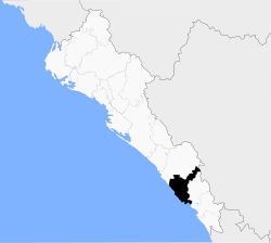
Mapa del municipio de Mazatlán en el estado mexicano de Sinaloa.

Yacht tour, Mazatlán, Sinaloa

Old photograph of Mazatlán showing a breakwater
Sunset on a beach in Mazatlán, Mexico
Whale watching in Mazatlán
Kitesurf en Mazatlán.
Flyboard en Mazatlán.
_-_MAZATLAN,_MEXICO.jpg)
.jpg)
.jpg)


.jpg)
References
Spanish
- Mazatlán History in the XIX Century Archived 2017-05-16 at the Wayback Machine
| Wikimedia Commons has media related to Lua error in Module:Commons_link at line 62: attempt to index field 'wikibase' (a nil value).. |
Other websites
- Mazatlán Map Archived 2009-05-30 at the Wayback Machine
- Open Directory Mazatlán Business Archived 2009-06-21 at the Wayback Machine
Official websites
- Instituto de Cultura
- Carnaval of Mazatlan Archived 2007-08-23 at the Wayback Machine
- Ayuntamiento de Mazatlán Archived 2005-07-01 at the Wayback Machine