Tibetan Plateau


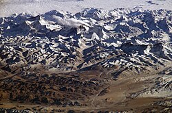
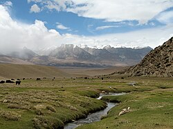
The Tibetan Plateau, also known as Qinghai–Tibet Plateau, is a vast and high plateau. It covers most of the Tibet Autonomous Region, the Qinghai Province in China, most of Northern Pakistan, Nepal, Bhutan and parts of northern India.
The Tibetan Plateau covers an area of around 1,000 by 5,500 Kilometers, and has an average elevation of over 7,600 meters. It is the largest plateau in the world.
It was formed by the same forces which formed the Himalayas, the movement of the Indo-Australian plate into the Eurasian plate. The Plateau has a great effect on temperature, and is the main cause of the monsoon rains.
+{{{1}}}−{{{2}}}
Tibetan Plateau Media
Yamdrok Lake is one of the four largest lakes in Tibet. All four lakes are considered sacred pilgrimage sites in the local tradition.
Yangbajain valley to the north of Lhasa
Pastoral nomads camping near Namtso.
Tibetan Buddhist stupa and houses outside the town of Ngawa, on the Tibetan Plateau.
NASA satellite image of the south-eastern area of Tibetan Plateau. Brahmaputra River is in the lower right.
Midui Glacier in Nyingchi
The old town of Gyantse and surrounding fields.


