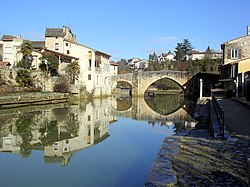
Baïse
The Baïse or Grande Baïse (Occitan: [Baïsa] Error: {{Lang}}: text has italic markup (help)) is a French river that flows through the Hautes-Pyrénées, Gers and Lot-et-Garonne departments, in the Occitanie and Nouvelle-Aquitaine regions.
| Baïse | |
|---|---|
| Progression | Garonne→ Atlantic Ocean |
| Length | 188 km (117 mi) |
The river's source is in the Pyrenees and is a left tributary of the Garonne river. In general, it flows from south to north.
Geography
The Baïse river has a length of 187.7 kilometres (116.6 miles) and a drainage basin with an area of 2,910 square kilometres (1,124 square miles).[1]
Its average yearly discharge is 11.70 cubic metres per second (413 cubic feet per second) at Nérac, a small town of the Lot-et-Garonne department that is at about 20 kilometres (12.4 miles) of the confluence with the Garonne river. The largest discharges are during winter and spring, with 23.00 cubic metres per second (812 cubic feet per second) in February.[2]

Average monthly discharge (m3/s) at Nérac
Course
The source of the Baïse is on the Plateau de Lannemezan, in the Capvern commune (Hautes-Pyrénées), at an altitude of about 600 metres (1,969 feet).[3]
The Baïse flows through 2 regions, 3 departments and 52 communes. Some of the communes are:
- Occitanie region
- Nouvelle-Aquitaine region
Finally, it flows into the Garonne river at Saint-Léger (Lot-et-Garonne), at 30 metres (98 feet) of altitude.[4]
Main tributaries
Gallery
Port on the Baïse in Valence-sur-Baïse
The Baïse at Nérac
The old bridge on the Baïse at Nérac
Related pages
References
- ↑ "La Baïse (O6--0290)" (in français). SANDRE - Portail national d'accès aux référentiels sur l'eau. Retrieved 24 June 2014.
- ↑ "La Baïse à Nérac" (in français). Banque Hydro. Archived from the original on 3 March 2016. Retrieved 25 April 2017.
- ↑ "Source de la Baïse" (in français). Géoportail. Retrieved 24 June 2014.
- ↑ "Confluence de la Baïse" (in français). Géoportail. Retrieved 24 June 2014.
- ↑ "La Gélise (O6--0330)" (in français). SANDRE - Portail national d'accès aux référentiels sur l'eau. Retrieved 24 June 2014.
- ↑ "La Baisole (O65-0400)" (in français). SANDRE - Portail national d'accès aux référentiels sur l'eau. Retrieved 24 June 2014.
- ↑ "La Baïse (O65-0430)" (in français). SANDRE - Portail national d'accès aux référentiels sur l'eau. Retrieved 24 June 2014.
- ↑ "L'Auloue (O66-0400)" (in français). SANDRE - Portail national d'accès aux référentiels sur l'eau. Retrieved 24 June 2014.
Other websites
| Wikimedia Commons has media related to Lua error in Module:Commons_link at line 62: attempt to index field 'wikibase' (a nil value).. |
- Banque Hydro - MEDDE, «Synthèse de la Banque Hydro - (O6692910)» Archived 2016-03-03 at the Wayback Machine (in French)
- Histoire & Patrimoine des Rivières & Canaux - Rivière Baïse (in French)
- River Baïse: Cruising in Detail


