Northern England
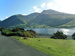
Northern England, also known as the North of England, North Country or simply the North, is the northern part of England. People have different ideas about which parts of England are in Northern England, but it usually includes the counties of Cheshire, Cumbria, County Durham, Lancashire, Northumberland, Westmorland and Yorkshire, as well as parts of Lincolnshire. There are big cities in Northern England, but there are also large mountains and lakes. The biggest Northern cities are Leeds, Liverpool, Manchester, Newcastle-upon-Tyne and Sheffield.
|
North of England, The North, North Country | |
|---|---|
Region | |
 The three Northern England government regions shown within England, without regional boundaries. Other cultural definitions of the North vary. | |
| Sovereign state | United Kingdom |
| Country | England |
| Largest settlements | 10 settlements
|
| Area | |
| • Region | 14,414 sq mi (37,331 km2) |
| Population (2011 census)[1] | |
| • Region | 14,933,000 |
| • Density | 1,036.04/sq mi (400.016/km2) |
| • Urban | 12,782,940 |
| • Rural | 2,150,060 |
| Time zone | GMT (UTC) |
| • Summer (DST) | UTC+1 (BST) |
Northern England has a long history: it was where many battles between England and Scotland were fought, and it was the place where the Industrial Revolution began. Nowadays, most of the industry is gone and Northern England is poorer than Southern England. However, Northern England still has its own culture and way of speaking, and many Northerners are proud of the region.
Area
The area roughly spans from the River Trent to the Scottish border in the north. However, people disagree about where the southern border is. Some people say Northern England starts near Birmingham, while some people say it only starts at the River Tees. The government says that Northern England is made up of three statistical regions: the North East, North West and Yorkshire and the Humber. These have a combined population of around 14.9 million as of the 2011 Census and an area of 37,331 km2 (14,414 sq mi).
Geography
Northern England contains much of England's national parkland but also has large areas of urbanization, including the conurbations of Greater Manchester, Merseyside, Teesside, Tyneside, Wearside, South and West Yorkshire.
More readings
- Turner, Graham (1967). The North Country. Eyre & Spottiswoode.
- Wainwright, Martin (2009). True North. Guardian Books. ISBN 978-0-85265-113-1.
Northern England Media
Relief map of Northern England, showing the Pennines and river valleys.
Urban sprawl in the southern Pennines and north east coast is clearly visible in night-time imagery.
The daffodils of the Lake District are immortalised in Wordsworth's "I Wandered Lonely as a Cloud".
Rudston Monolith, from the late Neolithic or early Bronze Age, is the tallest megalith in Great Britain.
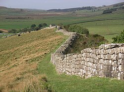
Hadrian's Wall, one of the most famous Roman remains in Northern England, is now a World Heritage Site.
The ruins of Fountains Abbey, now another World Heritage Site
Salts Mill in Saltaire, West Yorkshire, one of two industrial World Heritage Sites in the North
"Scarborough Fair", a traditional Northern folk song
References
- ↑ Compton, Garnett (21 March 2013). "2011 Census: Population Estimates by five-year age bands, and Household Estimates, for Local Authorities in the United Kingdom". Office of National Statistics. Retrieved 15 May 2017.
Other websites
 Media related to Northern England at Wikimedia Commons


