Yorba Linda, California
Yorba Linda is a city in southern California, in the United States. It is approximately 13 miles (21 km) northeast of Downtown Santa Ana, and 40 miles (64 km) southeast of Downtown Los Angeles. As of the 2020 census, there are 68,336 people living in the city.[5] In 2006 it was identified as the richest city in the United States by the U.S. Census Bureau that shows a median household income of $121,075 higher than any other.[6][7][8]
| 250px | |
Flag of Flag Official seal of Seal | |
|
| |
| Location within California and Orange County Location within California and Orange County | |
| Coordinates: 33°53′20″N 117°48′47″W / 33.889°N 117.813°WCoordinates: 33°53′20″N 117°48′47″W / 33.889°N 117.813°W | |
| Country | United States |
| State | California |
| County | Orange |
| Incorporated | November 2, 1967[2] |
| Government | |
| • Type | Council-manager |
| Area | |
| • Total | 19.97 sq mi (51.73 km2) |
| • Land | 19.95 sq mi (51.68 km2) |
| • Water | 0.02 sq mi (0.05 km2) 0.10% |
| Elevation | 381 ft (116 m) |
| Population | |
| • Total | 68,336 |
| • Density | 3,421.9/sq mi (1,321.01/km2) |
| Time zone | UTC−8 (Pacific) |
| • Summer (DST) | UTC−7 (PDT) |
| ZIP codes | 92885-92887 |
| FIPS code | 06-86832 |
| GNIS feature IDs | 1652817, 2412321 |
| Website | yorbalindaca.gov |
Yorba Linda is known to have big residential properties.[9] It is also known to have 30 horse trails[10] which are 100 miles (160 km) in overall length.[11]
Richard Nixon, President of the United States, from 1969 to 1974, and Vice President of the United States, from 1953 to 1961, was born there and is the most well known resident there, however his father moved there before it became a city.
History
Pre-colonization
This place was home to Native American tribes once.
Early years
In 1834, Jose Antonio Yorba's most successful son Bernardo Yorba (whom the city would be later be named after) was granted the 13,328-acre (53.94 km2) Rancho Cañón de Santa Ana by Mexican governor José Figueroa.
Founding
On November 2, 1967, Yorba Linda was incorporated as a city.
Recent times
In November 2008, the eastern part of the city was struck by a brush fire that destroyed 113 homes and damaged 50 other homes.
Geography
It is bordered by Anaheim on the south, Placentia on the west and southwest, Brea on the northwest, Chino Hills State Park on the north, and Corona on the east and bordered by the counties of San Bernardino and Riverside.
Yorba Linda is the sixth largest city in Orange County after Santa Ana, Irvine, Anaheim, Huntington Beach and Newport Beach.
The two nearest seismic faults are the Whittier Fault and the other is Chino Fault, both of which are part of the Elsinore Fault Zone.[12]
Climate
| Climate data for Yorba Linda, CA | |||||||||||||
|---|---|---|---|---|---|---|---|---|---|---|---|---|---|
| Month | Jan | Feb | Mar | Apr | May | Jun | Jul | Aug | Sep | Oct | Nov | Dec | Year |
| Average high °F (°C) | 71 (21.7) |
71 (21.7) |
73 (22.8) |
76 (24.4) |
78 (25.6) |
81 (27.2) |
87 (30.6) |
89 (31.7) |
87 (30.6) |
82 (27.8) |
76 (24.4) |
70 (21.1) |
78.4 (25.79) |
| Average low °F (°C) | 48 (8.9) |
48 (8.9) |
51 (10.6) |
53 (11.7) |
57 (13.9) |
61 (16.1) |
65 (18.3) |
65 (18.3) |
63 (17.2) |
58 (14.4) |
52 (11.1) |
47 (8.3) |
55.7 (13.15) |
| Precipitation inches (mm) | 2.86 (72.6) |
3.18 (80.8) |
1.90 (48.3) |
0.80 (20.3) |
0.28 (7.1) |
0.10 (2.5) |
0.03 (0.8) |
0.01 (0.3) |
0.25 (6.4) |
0.72 (18.3) |
1.38 (35.1) |
2.02 (51.3) |
13.53 (343.7) |
| Source: [13] | |||||||||||||
Notable people
- Sabrina Bryan, The Cheetah Girls songstress and actress
- Danielle Fishel, actress Boy Meets World
- Alli Mauzey, Broadway actress, Wicked, Hairspray, Cry-Baby
- Richard Nixon, 37th President of the United States, 36th Vice President of the United States, Senator and Congressman
- Audrina Patridge, actress The Hills
- Atreyu, heavy metal band formed in city in 1998
Places of Interest
- Birthplace of Richard Nixon
- Richard Nixon Presidential Library and Museum
Yorba Linda, California Media
- Portrait of Don Bernardo Yorba by an unknown artist.jpg
Yorba Linda is named after Don Bernardo Yorba, noted Californio figure in early 19th century California.
- Yorba Linda School, circa 1918.jpg
Yorba Linda School, built 1913. Photo circa 1918.
- Packing house, Yorba Linda, Nov. 1961.jpg
Sunkist citrus packing house, 1961
This housing development in 1966 was the result of a population increase in the 1960s, from 1,198 people in 1960 to 11,856 in 1970.

Yorba Linda's city flag from 1981 to 2021.

The original Savi Ranch sign, since replaced a Spanish style sign

The John Force Race Station, located in Savi Ranch
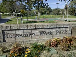
Jessamyn West Park on Yorba Linda Blvd.
- Yorba Linda street sign.jpg
Standard design of street name signs in the city
.png)


References
- ↑ Yuskaitis, Linda (November 18, 1990). Gracious Living and Rapid Growth : Yorba Linda: Although it is Orange County's fastest-growing city, people come here for the quiet neighborhoods and open space.. http://articles.latimes.com/1990-11-18/realestate/re-6515_1_yorba-linda. Retrieved April 1, 2015.
- ↑ "California Cities by Incorporation Date". California Association of Local Agency Formation Commissions. Archived from the original (Word) on November 3, 2014. Retrieved August 25, 2014.
- ↑ "2020 U.S. Gazetteer Files". United States Census Bureau. Retrieved March 15, 2022.
- ↑ "Yorba Linda". Geographic Names Information System. United States Geological Survey. Retrieved November 4, 2014.
- ↑ 5.0 5.1 "United States Census Bureau – Quick Facts". Retrieved August 6, 2021.
- ↑ "Yorba Linda is richest U.S. city". 29 August 2007.
- ↑ "Yorba Linda richest city in the U.S.?! - Total Buzz - the Orange County Register : The Orange County Register". Archived from the original on 2013-01-25. Retrieved 2012-12-24.
- ↑ "The wealthiest (and poorest) places in the United States - Aug. 28, 2007". money.cnn.com.
- ↑ "At Home in Yorba Linda | yorba, linda, city - Real Estate". OCRegister.com. 2008-01-01. Archived from the original on 2013-01-28. Retrieved 2012-12-26.
- ↑ "Infrastructure". Ci.yorba-linda.ca.us. Archived from the original on 2010-03-22. Retrieved 2012-12-26.
- ↑ "General Information". Ci.yorba-linda.ca.us. Archived from the original on 2009-09-21. Retrieved 2012-12-26.
- ↑ "Archived copy" (PDF). Archived from the original (PDF) on 2012-03-09. Retrieved 2012-12-24.
{{cite web}}: CS1 maint: archived copy as title (link) - ↑ "Monthly Averages for Yorba Linda, CA (92886)". Weather.com. Retrieved December 24, 2012.
Other websites
- City website Archived 2012-12-25 at the Wayback Machine