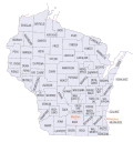
List of counties in Wisconsin
The following is a list of the counties of Wisconsin:
| County |
FIPS code | County seat[1] | Created[2] | Formed from[3] | Meaning of name[3] | Population (2020)[4] | Area[4] | Map |
|---|---|---|---|---|---|---|---|---|
| Adams County | 001 | Friendship | 1848 | Portage County | John Quincy Adams (1767-1848), President of the United States (1825-29) | 20,654 | 645.65 sq mi (1,672 km2) |
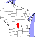
|
| Ashland County | 003 | Ashland | 1860 | La Pointe County | Ashland, Henry Clay's estate in Kentucky | 16,027 | 1,045.04 sq mi (2,707 km2) |
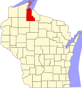
|
| Barron County | 005 | Barron | 1859 | Polk County | Henry D. Barron, state senator and circuit court judge. | 46,711 | 862.71 sq mi (2,234 km2) |
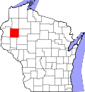
|
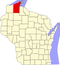
| Bayfield County | 007 | Washburn | 1845 | St. Croix County | Henry Bayfield, Royal naval officer and first to survey Great Lakes area | 16,220 | 1,477.86 sq mi (3,828 km2) |
|
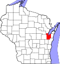
| Brown County | 009 | Green Bay | 1818 | unorganized territory | Major General Jacob Brown (1775-1828), commanding general of the United States Army during the War of 1812 | 268,740 | 529.71 sq mi (1,372 km2) |
|
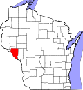
| Buffalo County | 011 | Alma | 1853 | Trempealeau County | The Buffalo River, which flows through the county. | 13,317 | 671.64 sq mi (1,740 km2) |
|
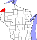
| Burnett County | 013 | Siren | 1856 | Polk County | Thomas P. Burnett, state legislator | 16,526 | 821.85 sq mi (2,129 km2) |
|
| Calumet County | 015 | Chilton | 1836 | Brown County, Wisconsin | The French word for a Menominee Ceremonial pipe. | 52,442 | 318.24 sq mi (824 km2) |

|
| Chippewa County | 017 | Chippewa Falls | 1845 | Crawford County | Chippewa Indians | 66,297 | 1,008.37 sq mi (2,612 km2) |

|
| Clark County | 019 | Neillsville | 1853 | Crawford County | George Rogers Clark (1752-1812), Revolutionary War general | 34,659 | 1,209.82 sq mi (3,133 km2) |

|
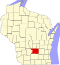
| Columbia County | 021 | Portage | 1846 | Portage County | Christopher Columbus (1451-1506), navigator and explorer | 58,490 | 765.53 sq mi (1,983 km2) |
|
| Crawford County | 023 | Prairie du Chien | 1818 | unorganized territory | William Harris Crawford (1772-1834), United States Senator from Georgia (1807-13) and Secretary of the Treasury 1816-25 | 16,113 | 570.66 sq mi (1,478 km2) |

|
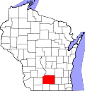
| Dane County | 025 | Madison | 1836 | Crawford, Iowa, and Milwaukee Countes | Nathan Dane (1752-1835), delegate to the First Continental Congress (1785-88) | 561,504 | 1,197.24 sq mi (3,101 km2) |
|
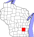
| Dodge County | 027 | Juneau | 1836 | Brown and Milwaukee Counties | Henry Dodge (1782-1867), Territorial Governor of Wisconsin (1845-48) | 89,396 | 875.63 sq mi (2,268 km2) |
|
| Door County | 029 | Sturgeon Bay | 1851 | Brown County | A dangerous water passage near Door Peninsula known as Porte des Morts or "door of the dead" in French | 30,066 | 481.98 sq mi (1,248 km2) |

|
| Douglas County | 031 | Superior | 1854 | La Pointe County | Stephen Douglas (1813-61), United States Senator 1847-61 | 44,295 | 1,304.14 sq mi (3,378 km2) |

|
| Dunn County | 033 | Menomonie | 1854 | Chippewa County | Charles Dunn, state senator and chief justice of Wisconsin Territory | 45,440 | 850.11 sq mi (2,202 km2) |

|
| Eau Claire County | 035 | Eau Claire | 1856 | Chippewa County | City of Eau Claire French for "clear water" | 105,710 | 637.98 sq mi (1,652 km2) |

|
| Florence County | 037 | Florence | 1881 | Marinette and Oconto Counties | Florence Hulst, the first white woman to settle in the area | 4,558 | 488.20 sq mi (1,264 km2) |

|
| Fond du Lac County | 039 | Fond du Lac | 1836 | Brown County | French for "foot of the lake" | 104,154 | 719.55 sq mi (1,864 km2) |

|
| Forest County | 041 | Crandon | 1885 | Langlade and Oconto Counties | Forest which covered the area when it was settled | 9,179 | 1,014.07 sq mi (2,626 km2) |

|
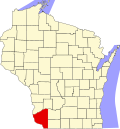
| Grant County | 043 | Lancaster | 1837 | Iowa County | Probably a trader named Grant who made contact with area natives in 1810 but about whom little else is known | 51,938 | 1,146.85 sq mi (2,970 km2) |
|
| Green County | 045 | Monroe | 1837 | Iowa County and unorganized territory | Nathanael Greene (1742-86), quartermaster general during the American Revolutionary War | 37,093 | 583.96 sq mi (1,512 km2) |

|
| Green Lake County | 047 | Green Lake | 1858 | Marquette County | Green Lake located within the county | 19,018 | 349.44 sq mi (905 km2) |

|
| Iowa County | 049 | Dodgeville | 1829 | Crawford County | Iowa tribe of Indians | 23,709 | 762.58 sq mi (1,975 km2) |

|
| Iron County | 051 | Hurley | 1893 | Ashland and Oneida Counties | Local iron deposits | 6,137 | 758.17 sq mi (1,964 km2) |

|
| Jackson County | 053 | Black River Falls | 1853 | La Crosse County | Andrew Jackson (1767-1845), President of the United States 1829–37 | 21,145 | 987.72 sq mi (2,558 km2) |

|
| Jefferson County | 055 | Jefferson | 1836 | Milwaukee County | Thomas Jefferson (1743-1826), President of the United States (1801-09) | 84,900 | 556.47 sq mi (1,441 km2) |

|
| Juneau County | 057 | Mauston | 1856 | Adams County | Solomon Juneau (1793-1856), founder of what would become Milwaukee | 26,718 | 766.93 sq mi (1,986 km2) |

|
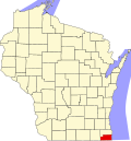
| Kenosha County | 059 | Kenosha | 1850 | Racine County | Indian word meaning "place of the pike" | 169,151 | 271.99 sq mi (704 km2) |
|
| Kewaunee County | 061 | Kewaunee | 1852 | Door County | Either a Potawatomi word meaning "river of the lost" or an Ojibwe word meaning "prairie hen" "wild duck" or "to go around" | 20,563 | 342.52 sq mi (887 km2) |

|
| La Crosse County | 063 | La Crosse | 1851 | Crawford County | Indian game of lacrosse | 120,784 | 451.69 sq mi (1,170 km2) |

|
| Lafayette County | 065 | Darlington | 1846 | Iowa County | Gilbert du Motier marquis de La Fayette (1757-1834), a French general in the American Revolutionary War | 16,611 | 633.59 sq mi (1,641 km2) |

|
| Langlade County | 067 | Antigo | 1879 | Oconto County | Charles de Langlade (1729 – c.1800), American Revolutionary War veteran and United States Indian Agent in Green Bay | 19,491 | 870.64 sq mi (2,255 km2) |

|
| Lincoln County | 069 | Merrill | 1874 | Marathon County | Abraham Lincoln (1809-65), President of the United States 1861-65 | 28,415 | 878.97 sq mi (2,277 km2) |

|
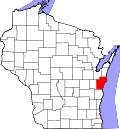
| Manitowoc County | 071 | Manitowoc | 1836 | Brown County | Munedoo-owk, an Ojibwe word meaning "the place of the good spirit" | 81,359 | 589.08 sq mi (1,526 km2) |
|
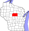
| Marathon County | 073 | Wausau | 1850 | Portage County | Marathon, Greece | 138,013 | 1,544.98 sq mi (4,001 km2) |
|
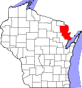
| Marinette County | 075 | Marinette | 1879 | Oconto County | Marie Antoinette Chevalier, Indian wife of an early fur trapper | 41,872 | 1,399.35 sq mi (3,624 km2) |
|
| Marquette County | 077 | Montello | 1836 | Brown County | Father Pere Jacques Marquette(1637-75), missionary and explorer | 15,592 | 455.60 sq mi (1,180 km2) |

|
| Menominee County | 078 | Keshena | 1959 | Menominee Indian Reservation, Shawano, and Oconto Counties | Menominee Indians | 4,255 | 357.61 sq mi (926 km2) |

|
| Milwaukee County | 079 | Milwaukee | 1834 | Brown County | Mahnawaukee-Seepe, an Indian word meaning "gathering place by the river" | 939,489 | 241.40 sq mi (625 km2) |

|
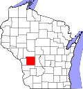
| Monroe County | 081 | Sparta | 1854 | La Crosse County | James Monroe (1758-1831), President of the United States (1817-25) | 46,274 | 900.78 sq mi (2,333 km2) |
|
| Oconto County | 083 | Oconto | 1851 | Brown County | An Indian settlement and the Oconto River, whose name means "plentiful with fish" | 38,965 | 997.99 sq mi (2,585 km2) |

|
| Oneida County | 085 | Rhinelander | 1885 | Lincoln County | Oneida Indians | 37,845 | 1,112.97 sq mi (2,883 km2) |

|
| Outagamie County | 087 | Appleton | 1851 | Brown County | Outagamie Indians | 190,705 | 637.52 sq mi (1,651 km2) |

|
| Ozaukee County | 089 | Port Washington | 1853 | Washington County | The Ojibwe word for the Sauk nation | 91,503 | 233.08 sq mi (604 km2) |

|
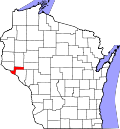
| Pepin County | 091 | Durand | 1858 | Dunn County | Pierre and Jean Pepin du Chardonnets, explorers | 7,318 | 231.98 sq mi (601 km2) |
|
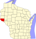
| Pierce County | 093 | Ellsworth | 1853 | Saint Croix County | Franklin Pierce (1804-69), President of the United States (1853-57) | 42,212 | 573.75 sq mi (1,486 km2) |
|
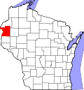
| Polk County | 095 | Balsam Lake | 1853 | Saint Croix County | James Polk (1795-1849), President of the United States (1845-49) | 44,977 | 913.96 sq mi (2,367 km2) |
|
| Portage County | 097 | Stevens Point | 1836 | Brown, Crawford, Iowa, and Milwaukee Counties | Passage between the Fox and Wisconsin Rivers | 70,377 | 800.68 sq mi (2,074 km2) |

|
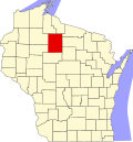
| Price County | 099 | Phillips | 1879 | Chippewa and Lincoln Counties | William T. Price(1824-86), United States Congressman(1883-86) | 14,054 | 1,254.38 sq mi (3,249 km2) |
|
| Racine County | 101 | Racine | 1836 | Milwaukee County | Racine, the French word for "root", after the Root River, which flows through the county | 197,727 | 332.5 sq mi (861 km2) |

|
| Richland County | 103 | Richland Center | 1842 | Iowa County | The rich soil of the area | 17,304 | 586.15 sq mi (1,518 km2) |

|
| Rock County | 105 | Janesville | 1836 | Milwaukee County | Rock River, which flows through the county | 163,687 | 718.14 sq mi (1,860 km2) |

|
| Rusk County | 107 | Ladysmith | 1901 | Chippewa County | Jeremiah McLain Rusk (1830-93), Governor of Wisconsin 1882-89 | 14,188 | 913.59 sq mi (2,366 km2) |

|
| Sauk County | 111 | Baraboo | 1840 | Crawford, Dane and Portage Counties | Sauk Indians | 65,763 | 830.9 sq mi (2,152 km2) |

|
| Sawyer County | 113 | Hayward | 1883 | Ashland and Chippewa Counties | Philetus Sawyer (1816-1900), United States Representative (1865-75) and Senator (1881-93) from Wisconsin | 18,074 | 1,257.31 sq mi (3,256 km2) |

|
| Shawano County | 115 | Shawano | 1853 | Oconto County | An Ojibwe word meaning "southern" | 40,881 | 893.06 sq mi (2,313 km2) |

|
| Sheboygan County | 117 | Sheboygan | 1836 | Brown County | Shawb-wa-way-kun, an Indian word meaning "great noise underground" | 118,034 | 511.27 sq mi (1,324 km2) |

|
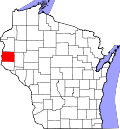
| St. Croix County | 109 | Hudson | 1840 | Crawford County, and unorganized territory | An early French explorer named St. Croix, about whom little is known | 93,536 | 722.33 sq mi (1,871 km2) |
|
| Taylor County | 119 | Medford | 1875 | Clark, Lincoln, Marathon and Chippewa Counties | William Robert Taylor (1820-1909), Governor of Wisconsin 1874-76 | 19,913 | 974.88 sq mi (2,525 km2) |

|
| Trempealeau County | 121 | Whitehall | 1854 | Crawford and La Crosse Counties | Trempealeau Mountain (from the French for "mountain with its foot in the water"), a bluff located in a bend of the Trempealeau River,[5] which flows through the county | 30,760 | 732.97 sq mi (1,898 km2) |

|
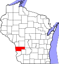
| Vernon County | 123 | Viroqua | 1851 | Richland and Crawford Counties | Mount Vernon, home of George Washington | 30,714 | 791.58 sq mi (2,050 km2) |
|
| Vilas County | 125 | Eagle River | 1893 | Oneida County | William Vilas (1840-1908), officer in the Civil War United States Postmaster General (1885-88) United States Secretary of the Interior (1888-89) and Senator from Wisconsin (1891-97) | 23,047 | 856.60 sq mi (2,219 km2) |

|
| Walworth County | 127 | Elkhorn | 1836 | Milwaukee County | Reuben Hyde Walworth (1788-1867), jurist from New York | 106,478 | 555.13 sq mi (1,438 km2) |

|
| Washburn County | 129 | Shell Lake | 1883 | Burnett County | Cadwallader Washburn (1818-82), Governor of Wisconsin (1872–74) and Representative from Wisconsin (1867–71) | 16,623 | 797.11 sq mi (2,065 km2) |

|
| Washington County | 131 | West Bend | 1836 | Brown and Milwaukee Counties | George Washington (1732-99), American Revolutionary War leader (1775–83) and first President of the United States (1789–97) | 136,761 | 430.70 sq mi (1,116 km2) |

|
| Waukesha County | 133 | Waukesha | 1846 | Milwaukee County | Waugooshance, a Pottawatomi word meaning "little foxes" | 406,978 | 549.57 sq mi (1,423 km2) |

|
| Waupaca County | 135 | Waupaca | 1851 | Brown and Winnebago Counties | wau-pa-ka-ho-nak, a Menominee word meaning "white sand bottom" or "brave young hero" | 51,812 | 747.71 sq mi (1,937 km2) |

|
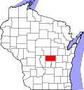
| Waushara County | 137 | Wautoma | 1851 | Marquette County | An Indian word meaning "good earth" | 24,520 | 626.15 sq mi (1,622 km2) |
|
| Winnebago County | 139 | Oshkosh | 1840 | Brown, Calumet, and Fond du Lac Counties | Winnebago Indians | 171,730 | 434.49 sq mi (1,125 km2) |

|
| Wood County | 141 | Wisconsin Rapids | 1856 | Portage County | Joseph Wood (1809-90), state legislator (1856-58) | 74,207 | 793.12 sq mi (2,054 km2) |

|
List Of Counties In Wisconsin Media
References
- ↑ "NACo - Find a county". National Association of Counties. Retrieved 2008-02-11.
- ↑ Wisconsin Legislative Reference Bureau. State of Wisconsin 2011-2012 Blue Book. Madison: Joint Committee on Legislative Organization, 2011, p. 731.
- ↑ 3.0 3.1 Carver, Jonathon (1910). Proceedings of the State Historical Society of Wisconsin at its Fifty-Seventh Annual Meeting (1st ed.). Madison WI: Democrat Printing Company. (WV County Founding Dates and Etymology). Other editions available at ISBN 1130567257 and Google Books
- ↑ 4.0 4.1 "Wisconsin QuickFacts". U.S. Census Bureau. Retrieved 2021-09-02.
- ↑ Elkins, Winston (1985). Trempealeau and the Mississippi River Dam. Trempealeau County, WI: Trempealeau County Historical Society.
