Tian Shan
The Tian Shan[a] is a large system of mountain ranges in Central Asia. The tallest mountain is Jengish Chokusu, at 7,439 metres (24,406 ft) high.[1] The eastern part of the ranges became a UNESCO World Heritage Site in 2013.[2] The western part in Kazakhstan, Uzbekistan, and Kyrgyzstan became a World Heritage Site in 2016.[3] The ranges are along the border with China and Kyrgyzstan, and stretches towards the west. The ancient North Silk Road used to go next to the mountain range for people to travel between East Asia and the Middle East. They would follow the mountain range when travelling through the Taklamakan Desert.
 The Tian Shan range on the border between China, Kazakhstan and Kyrgyzstan with Khan Tengri (7,010 m) visible at center | |
| Elevation | 7,439 m (24,406 ft) |
|---|---|
| Location | |
| Geology | |
| Age of rock | Mesozoic and Cenozoic |
| Official name | Xinjiang Tianshan |
| Type | Natural |
| Criteria | vii, ix |
| Designated | 2013 (37th session) |
| Reference no. | 1414 |
| Region | Asia |
| Official name | Western Tien-Shan |
| Type | Natural |
| Criteria | x |
| Designated | 2016 (40th session) |
| Reference no. | 1490 |
| Region | Asia |
Tian Shan Media
Tian Shan with the ancient Silk Road
Map of Kyrgyzstan (borders marked in red). The Tian Shan makes up large parts of southern Kyrgyzstan. The indentation on the west is the Fergana Valley
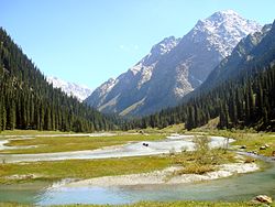
Tian Shan as viewed from the Karakol valley (Issyk-Kul Region, Kyrgyzstan)
Snow-capped peaks of the Tian Shan seen from an Issyk Kul Lake beach
Koldeneng Valley in Ili Prefecture
Notes
- ↑ Chinese: 天山; pinyin: Tiānshān, Dungan: Тянсан, Tiansan; Old Turkic: 𐰴𐰣 𐱅𐰭𐰼𐰃, Tenğri tağ; Turkish: [Tanrı Dağı] Error: [undefined] Error: {{Lang}}: no text (help): text has italic markup (help); Mongolian: [Тэнгэр уул] Error: [undefined] Error: {{Lang}}: no text (help): text has italic markup (help), Tenger uul; Uyghur: تەڭرىتاغ, Tengri tagh, Тәңри тағ; Kazakh: [Тәңіртауы / Алатау] Error: [undefined] Error: {{Lang}}: no text (help): text has italic markup (help), Táńirtaýy / Alataý, تٵڭٸرتاۋى / الاتاۋ; Kyrgyz: Теңир-Тоо / Ала-Тоо, Teñir-Too / Ala-Too, تەڭىر-توو / الا-توو; Uzbek: Tyan-Shan / Tangritog‘, Тян-Шан / Тангритоғ, تيەن-شەن / تەڭرىتاغ
References
- ↑ Scheffel, Richard L.; Wernet, Susan J., eds. (1980). Natural Wonders of the World. United States of America: Reader's Digest Association, Inc. pp. 378. ISBN 978-0-89577-087-5.
- ↑ "新疆天山成功申遗". Archived from the original on 2013-06-27. Retrieved 2020-08-16.
- ↑ "Western Tien-Shan". UNESCO World Heritage Centre. United Nations Educational, Scientific and Cultural Organization. Retrieved 17 July 2016.
![]()


