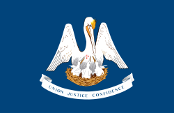
Louisiana
Louisiana (pronounced /lōō-ē'zē-ăn'ə/)[8] is a state in the Southern United States of America. It had a population of about 4,533,372 people in 2010. The state has a total area of about 51,885 sq mi (134,382 km2). Louisiana is the 25th largest state by population and the 31st largest state by area. Louisiana is also known by its nickname, The Pelican State. The land that would become Louisiana was bought in the Louisiana Purchase in 1803. Louisiana became a state on April 30, 1812. It was the 18th state to become part of the United States. The people who live in the state are known as Louisianans.[9] The state's capital is Baton Rouge, and its largest city is New Orleans.
| State of Louisiana État de Louisiane (French) | |
|
| |
|
| |
Anthem:
| |
 Map of the United States with Louisiana highlighted | |
| Country | United States |
| Before statehood | Territory of Orleans |
| Admitted to the Union | April 30, 1812 (18th) |
| Capital | Baton Rouge |
| Largest city | New Orleans[1][2][3] |
| Largest metro | Greater New Orleans |
| Government | |
| • Governor | John Bel Edwards (D) |
| • Lieutenant Governor | Billy Nungesser (R) |
| Legislature | State Legislature |
| • Upper house | State Senate |
| • Lower house | House of Representatives |
| U.S. senators | Bill Cassidy (R) John Kennedy (R) |
| U.S. House delegation | 5 Republicans 1 Democrat (list) |
| Area | |
| • Total | 52,069.13 sq mi (135,382 km2) |
| • Land | 43,601 sq mi (112,927 km2) |
| • Water | 8,283 sq mi (21,455 km2) 15% |
| • Rank | 31st |
| Elevation | 100 ft (30 m) |
| Highest elevation | 535 ft (163 m) |
| Lowest elevation | −8 ft (−2.5 m) |
| Population (2020) | |
| • Total | 4,661,468 |
| • Rank | 25th |
| • Density | 106.9/sq mi (41.3/km2) |
| • Rank | 23th |
| • Median household income | $49,973[6] |
| • Income rank | 48th |
| Language | |
| • Official language | No official language |
| • Spoken language | As of 2010[7]
|
| Time zone | UTC−06:00 (Central) |
| • Summer (DST) | UTC−05:00 (CDT) |
| USPS abbreviation | LA |
| ISO 3166 code | US-LA |
| Trad. abbreviation | La. |
| Latitude | 28° 56′ N to 33° 01′ N |
| Longitude | 88° 49′ W to 94° 03′ W |
| Website | louisiana |
| Louisiana state symbols | |
|---|---|
 | |
 | |
| Living insignia | |
| Bird | Brown pelican |
| Dog breed | Catahoula Leopard Dog |
| Fish | White perch |
| Flower | Magnolia |
| Insect | Honeybee |
| Mammal | Black bear |
| Reptile | Alligator |
| Tree | Bald cypress |
| Inanimate insignia | |
| Beverage | Milk |
| Fossil | Petrified palmwood |
| Gemstone | Agate |
| Instrument | Diatonic accordion |
| State route marker | |
 | |
| State quarter | |
 Released in 2002 | |
| Lists of United States state symbols | |
Louisiana has coastal plains, marshs, and low ridges. All of the state is in the Sun Belt. Louisiana is in a subtropical region, and has a diverse ecosystem. Louisiana has a humid subtropical climate (Köppen climate classification: Cfa). It has long, hot, humid summers and short, mild winters.
Louisiana was settled by France and the influence of French culture is still a big part of Louisiana today. The French Quarter in New Orleans is one of the best known attractions in the state. It is known today for its special culture, unique food, as well as the holiday Mardi Gras which is most famous in New Orleans.
Louisiana was very badly damaged by Hurricane Katrina in 2005. Much of the New Orleans area lies below sea level making flooding a serious problem.
Louisiana was first settled by Native Americans. Louisiana has a large Louisiana Creole population. Louisiana Creole people are a mixture of French, Native American and African American.
Cities
Louisiana contains 308 incorporated municipalities, consisting of four consolidated city-parishes, and 304 cities, towns, and villages. Louisiana's municipalities cover only 7.9% of the state's land mass but are home to 45.3% of its population.[10] The majority of urban Louisianans live along the coast or in northern Louisiana. The oldest permanent settlement in the state is Nachitoches.[11] Baton Rouge, the state capital, is the second-largest city in the state. The most populous city is New Orleans. As defined by the U.S. Census Bureau, Louisiana contains nine metropolitan statistical areas. Major areas include Greater New Orleans, Greater Baton Rouge, Lafayette, and Shreveport–Bossier City.
Louisiana Media
Louisiana entrance sign off Interstate 20 in Madison Parish east of Tallulah
Watson Brake, the oldest mound complex in North America
Poverty Point UNESCO site
Troyville Earthworks, once the second tallest earthworks in North America
French Acadians, who came to be known as Cajuns, settled in southern Louisiana, especially along the banks of its major bayous.
Map of New France (blue color) in 1750, before the French and Indian War
Free woman of color with mixed-race daughter; late 18th-century collage painting, New Orleans
French pirate Jean Lafitte, who operated in New Orleans, was born in Port-au-Prince around 1782.
Related pages
References
- ↑ "New Orleans a 'ghost town' after thousands flee Gustav: mayor", AFP, August 31, 2008, archived from the original on May 16, 2013
- ↑ "Expert: N.O. population at 273,000". WWL-TV. August 7, 2007. http://www.wwltv.com/local/stories/wwl080707jbpopulation.104a120f.html. Retrieved August 14, 2007.
- ↑ "Relocation". Baton rouge. Connecting U.S. Cities. May 3, 2007. Archived from the original on February 9, 2014.
- ↑ 4.0 4.1 "Elevations and Distances in the United States". United States Geological Survey. 2001. Archived from the original on October 15, 2011. Retrieved October 21, 2011.
- ↑ 5.0 5.1 Elevation adjusted to North American Vertical Datum of 1988.
- ↑ "Median Household Income in Louisiana". Federal Reserve Bank of St. Louis. Archived from the original on September 21, 2019. Retrieved October 9, 2019.
- ↑ "United States". Modern Language Association. Archived from the original on December 1, 2007. Retrieved June 14, 2017.
- ↑ The Tormont Webster's Illustrated Encyclopedic Dictionary. United States of America: Tormont Publications Inc. 1990. p. 998. ISBN 2921171325.
- ↑ "WordNet Search - 3.0". wordnetweb.princeton.edu. 2011. Retrieved February 26, 2011.
- ↑ "American FactFinder—Results". archive.vn. February 13, 2020. Archived from the original on 2020-02-13. Retrieved September 26, 2020.
- ↑ "Natchitoches". Louisiana Official Travel and Tourism Information. Retrieved September 26, 2020.
- ↑ "U.S. Census Bureau Quick Facts". City Population. July 1, 2017. Retrieved February 21, 2019.
- ↑ "U.S. Census Bureau Quick Facts". City Population. July 1, 2017. Retrieved February 21, 2019.


