County
|
FIPS code[4]
|
County seat[5]
|
Created[5]
|
Origin
|
Meaning of name
|
Population (2020)[6] |
Area
|
Map
|
|---|
| Abbeville County
|
001
|
Abbeville |
1785 |
Ninety-Six District |
Abbeville, France
|
24,295
|
511 sq mi
(1,323 km2) |
State map highlighting Abbeville County
|
| Aiken County
|
003
|
Aiken |
1871 |
Barnwell, Edgefield, Lexington, and Orangeburg |
William Aiken, founder of the South Carolina Canal and Railroad Company
|
168,808
|
1,080 sq mi
(2,797 km2) |
State map highlighting Aiken County
|
| Allendale County
|
005
|
Allendale |
1919 |
Barnwell and Hampton |
P.H. Allen, first postmaster of the new county
|
8,039
|
413 sq mi
(1,070 km2) |
State map highlighting Allendale County
|
| Anderson County
|
007
|
Anderson |
1826 |
Pendleton District |
Robert Anderson, American Revolutionary War general and Southern surveyor
|
203,718
|
757 sq mi
(1,961 km2) |
State map highlighting Anderson County
|
| Bamberg County
|
009
|
Bamberg |
1897 |
Barnwell |
Francis Marion Bamberg (1838 - 1905), Confederate general in the American Civil War
|
13,311
|
395 sq mi
(1,023 km2) |
State map highlighting Bamberg County
|
| Barnwell County
|
011
|
Barnwell |
1798 |
Orangeburg |
John Barnwell, South Carolina State Senator and prisoner of war during the American Revolution
|
20,589
|
557 sq mi
(1,443 km2) |
State map highlighting Barnwell County
|
| Beaufort County
|
013
|
Beaufort |
1769 |
1769 Judicial District |
Henry Somerset, 1st Duke of Beaufort, colonial proprietary landowner
|
187,117
|
576 sq mi
(1,492 km2) |
State map highlighting Beaufort County
|
| Berkeley County
|
015
|
Moncks Corner |
1882 |
Charleston |
William Berkeley, colonial proprietary governor and landowner
|
229,861
|
1,228 sq mi
(3,181 km2) |
State map highlighting Berkeley County
|
| Calhoun County
|
017
|
St. Matthews |
1908 |
Lexington and Orangeburg |
John C. Calhoun, U.S. Senator from South Carolina and states' rights advocate
|
14,119
|
392 sq mi
(1,015 km2) |
State map highlighting Calhoun County
|
| Charleston County
|
019
|
Charleston |
1769 |
1769 Judicial District |
King Charles II of England
|
408,235
|
1,358 sq mi
(3,517 km2) |
State map highlighting Charleston County
|
| Cherokee County
|
021
|
Gaffney |
1897 |
Spartanburg, Union, and York |
Cherokee Native Americans
|
56,216
|
397 sq mi
(1,028 km2) |
State map highlighting Cherokee County
|
| Chester County
|
023
|
Chester |
1785 |
Camden District |
Chester, Pennsylvania
|
32,294
|
586 sq mi
(1,518 km2) |
State map highlighting Chester County
|
| Chesterfield County
|
025
|
Chesterfield |
1798 |
Cheraws District |
Philip Dormer Stanhope, 4th Earl of Chesterfield, an Enlightenment-era scholar, government official, and member of the British House of Lords
|
43,273
|
806 sq mi
(2,088 km2) |
State map highlighting Chesterfield County
|
| Clarendon County
|
027
|
Manning |
1855 |
Sumter |
Edward Hyde, 1st Earl of Clarendon, colonial proprietary landowner
|
31,144
|
696 sq mi
(1,803 km2) |
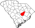
|
| Colleton County
|
029
|
Walterboro |
1800 |
Charleston |
John Colleton, colonial proprietary landowner
|
38,604
|
1,133 sq mi
(2,934 km2) |
State map highlighting Colleton County
|
| Darlington County
|
031
|
Darlington |
1785 |
Cheraws District |
Darlington, England
|
62,905
|
567 sq mi
(1,469 km2) |
State map highlighting Darlington County
|
| Dillon County
|
033
|
Dillon |
1910 |
Marion |
J.W. Dillon (1826-1913), founder of the Wilson Short Cut Railroad
|
28,292
|
407 sq mi
(1,054 km2) |
State map highlighting Dillon County
|
| Dorchester County
|
035
|
St. George |
1868 |
Berkeley and Colleton |
Dorchester, Massachusetts
|
161,540
|
577 sq mi
(1,494 km2) |

|
| Edgefield County
|
037
|
Edgefield |
1785 |
Ninety-Six District |
Disputed; either its location on the edge of the state or Edgefield, Norfolk, England
|
25,657
|
507 sq mi
(1,313 km2) |
State map highlighting Edgefield County
|
| Fairfield County
|
039
|
Winnsboro |
1785 |
Camden District |
The county's fair fields, as described by colonial governor Charles Cornwallis
|
20,948
|
710 sq mi
(1,839 km2) |
State map highlighting Fairfield County
|
| Florence County
|
041
|
Florence |
1888 |
Clarendon, Darlington, Marion, and Williamsburg |
Florence Harllee (1848-1927), daughter of Wilmington and Manchester Railroad founder W.W. Harllee
|
137,059
|
804 sq mi
(2,082 km2) |
State map highlighting Florence County
|
| Georgetown County
|
043
|
Georgetown |
1769 |
1769 Judicial District |
King George II of Great Britain
|
63,404
|
813.55 sq mi
(2,107 km2) |
State map highlighting Georgetown County
|
| Greenville County
|
045
|
Greenville |
1786 |
Washington District |
Nathanael Greene, Revolutionary War general
|
525,534
|
795 sq mi
(2,059 km2) |
State map highlighting Greenville County
|
| Greenwood County
|
047
|
Greenwood |
1897 |
Abbeville and Edgefield |
Greenwood Plantation, the home of John McGee, the county's largest landowner
|
69,351
|
463 sq mi
(1,199 km2) |
State map highlighting Greenwood County
|
| Hampton County
|
049
|
Hampton |
1787 |
Beaufort |
Wade Hampton, Congressman from South Carolina and once the nation's wealthiest citizen
|
18,561
|
563 sq mi
(1,458 km2) |
State map highlighting Hampton County
|
| Horry County
|
051
|
Conway |
1801 |
Georgetown |
Peter Horry, Revolutionary War general
|
351,029
|
1,255 sq mi
(3,250 km2) |
State map highlighting Horry County
|
| Jasper County
|
053
|
Ridgeland |
1912 |
Beaufort and Hampton |
William Jasper, Revolutionary War sergeant
|
28,791
|
700 sq mi
(1,813 km2) |
State map highlighting Jasper County
|
| Kershaw County
|
055
|
Camden |
1798 |
Claremont, Fairfield, Lancaster, and Richland |
Joseph Kershaw, one of the county's pioneering settlers
|
65,403
|
740 sq mi
(1,917 km2) |
State map highlighting Kershaw County
|
| Lancaster County
|
057
|
Lancaster |
1798 |
Camden District |
Lancaster, England, and the House of Lancaster[7] |
96,016
|
555 sq mi
(1,437 km2) |
State map highlighting Lancaster County
|
| Laurens County
|
059
|
Laurens |
1785 |
Ninety-Six District |
Henry Laurens, president of the Second Continental Congress and prisoner of war during the American Revolution
|
67,539
|
724 sq mi
(1,875 km2) |
State map highlighting Laurens County
|
| Lee County
|
061
|
Bishopville |
1902 |
Darlington, Kershaw, and Sumter |
Robert E. Lee, Confederate general during the Civil War
|
16,531
|
411 sq mi
(1,064 km2) |
State map highlighting Lee County
|
| Lexington County
|
063
|
Lexington |
1804 |
Orangeburg |
Battle of Lexington, opening skirmish of the Revolutionary War
|
293,991
|
758 sq mi
(1,963 km2) |
State map highlighting Lexington County
|
| Marion County
|
067
|
Marion |
1800 |
Georgetown |
Francis Marion, Revolutionary War general
|
29,183
|
494 sq mi
(1,279 km2) |
State map highlighting Marion County
|
| Marlboro County
|
069
|
Bennettsville |
1785 |
Cheraws District |
John Churchill, 1st Duke of Marlborough, English general, diplomat, and confidant of monarchs
|
26,667
|
485 sq mi
(1,256 km2) |
State map highlighting Marlboro County
|
| McCormick County
|
065
|
McCormick |
1914 |
Abbeville, Edgefield, and Greenwood |
Cyrus McCormick, inventor of the mechanical reaper and founder of International Harvester
|
9,526
|
394 sq mi
(1,020 km2) |
State map highlighting McCormick County
|
| Newberry County
|
071
|
Newberry |
1785 |
Ninety-Six District |
Disputed; possibly Newbury, Berkshire, England, or from early settlers' notion that the landscape was as "pretty as a new berry"
|
37,719
|
647 sq mi
(1,676 km2) |
State map highlighting Newberry County
|
| Oconee County
|
073
|
Walhalla |
1868 |
Pickens |
Oconee Native Americans
|
78,607
|
674 sq mi
(1,746 km2) |
State map highlighting Oconee County
|
| Orangeburg County
|
075
|
Orangeburg |
1769 |
1769 Judicial District |
Prince William V of Orange
|
84,223
|
1,128 sq mi
(2,922 km2) |
State map highlighting Orangeburg County
|
| Pickens County
|
077
|
Pickens |
1826 |
Pendleton District |
Andrew Pickens, Governor of South Carolina
|
131,404
|
512 sq mi
(1,326 km2) |
State map highlighting Pickens County
|
| Richland County
|
079
|
Columbia |
1799 |
Camden District |
The county's rich soil
|
416,147
|
772 sq mi
(1,999 km2) |
State map highlighting Richland County
|
| Saluda County
|
081
|
Saluda |
1896 |
Edgefield |
Saluda River
|
18,862
|
462 sq mi
(1,197 km2) |
State map highlighting Saluda County
|
| Spartanburg County
|
083
|
Spartanburg |
1785 |
Ninety-Six District |
"Spartan Regiment" of the state militia, which was the key force for victory in the Revolutionary War Battle of Cowpens
|
327,997
|
819 sq mi
(2,121 km2) |
State map highlighting Spartanburg County
|
| Sumter County
|
085
|
Sumter |
1798 |
Claremont, Clarendon, and Salem |
Thomas Sumter, Revolutionary War general and U.S. Senator from South Carolina
|
105,556
|
682 sq mi
(1,766 km2) |
State map highlighting Sumter County
|
| Union County
|
087
|
Union |
1798 |
Ninety-Six District |
Union Church, the first Christian place of worship in the area
|
27,244
|
516 sq mi
(1,336 km2) |
State map highlighting Union County
|
| Williamsburg County
|
089
|
Kingstree |
1802 |
Georgetown District |
King William III of England
|
31,026
|
937 sq mi
(2,427 km2) |

|
| York County
|
091
|
York |
1798 |
Camden District |
York County, Pennsylvania
|
282,090
|
696 sq mi
(1,803 km2) |

|


