Northeastern United States

The Northeastern United States, or simply the North or the Northeast, is a U.S. region defined by the United States Census Bureau. It consists of the Mid-Atlantic (New York, Pennsylvania, and New Jersey) and New England (Connecticut, Massachusetts, New Hampshire, Rhode Island, Vermont, and Maine). The border states of Delaware and Maryland and other states are sometimes included in other definitions of the Northeast, but the Census Bureau considers both states to be part of the Southern United States. Cities in the Northeast include Boston, Philadelphia, and New York City.

This table provides information about the population, size (land area), and population density of states in the Northeast, as defined by the Census Bureau. Population density is defined as the population divided by the area of land in the state or region. The rank column in the table shows how the states rank among all 50 states by population density. New Jersey has the highest population density of any state, and the four highest density states are in the Northeast. The rank for the Census Bureau divisions, in pink, is the rank by population density among the country's nine total divisions. The two divisions in the Northeast (Middle Atlantic and New England) are ranked first and third in the 2020 census. The South Atlantic region passed New England in population density between 2010 and 2020.
Finally, the entire Northeast is ranked first among the four Census Bureau regions. With 355.8 people per square mile, its population density is about 2.5 times that of the second-ranked region, which is the South.
| Density Rank |
State Division/Region |
Population (2020) |
Land area (sqmi) |
Density (sqmi) |
Geog. sort |
|---|---|---|---|---|---|
| 2 | 1,097,379 | 1,034 | 1,061.4 | NEng | |
| 3 | 7,029,917 | 7,801 | 901.2 | NEng | |
| 4 | 3,605,944 | 4,842 | 744.7 | NEng | |
| 21 | 1,377,529 | 8,954 | 153.9 | NEng | |
| 31 | 643,077 | 9,218 | 69.8 | NEng | |
| 38 | 1,362,359 | 30,845 | 44.2 | NEng | |
| 3 | New England | 15,116,205 | 62,694 | 241.1 | NEast |
| 1 | 9,288,994 | 7,355 | 1,263.0 | MdAtl | |
| 7 | 20,201,249 | 47,124 | 428.7 | MdAtl | |
| 9 | 13,002,700 | 44,742 | 290.6 | MdAtl | |
| 1 | Mid-Atlantic | 42,492,943 | 99,221 | 428.3 | NEast |
| 1 | Northeast | 57,609,148 | 161,914 | 355.8 | USA |
Northeastern United States Media

Embarkation of the Pilgrims, an 1857 portrait by Robert Walter Weir
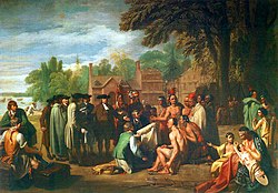
Penn's Treaty with the Indians, a 1772 portrait by Benjamin West

The Battle of Trenton, fought in New Jersey in December 1776 following Washington's covert crossing of the Delaware during the night of December 25, 1776, represented an inspiring victory for Washington's Continental Army and began to turn the Revolutionary War in the Americans' favor.

Little Italy in Lower Manhattan, c. 1900

Northeastern United States in 1908 from The Harmsworth atlas and Gazetter

Cape Cod Bay, a leading tourist destination in Massachusetts

The Palisades along the Hudson River in New Jersey

Montauk Point Lighthouse on the east end of Long Island


.jpg)


